
MyTopo
Pyramid Hills California US Topo Map
Couldn't load pickup availability
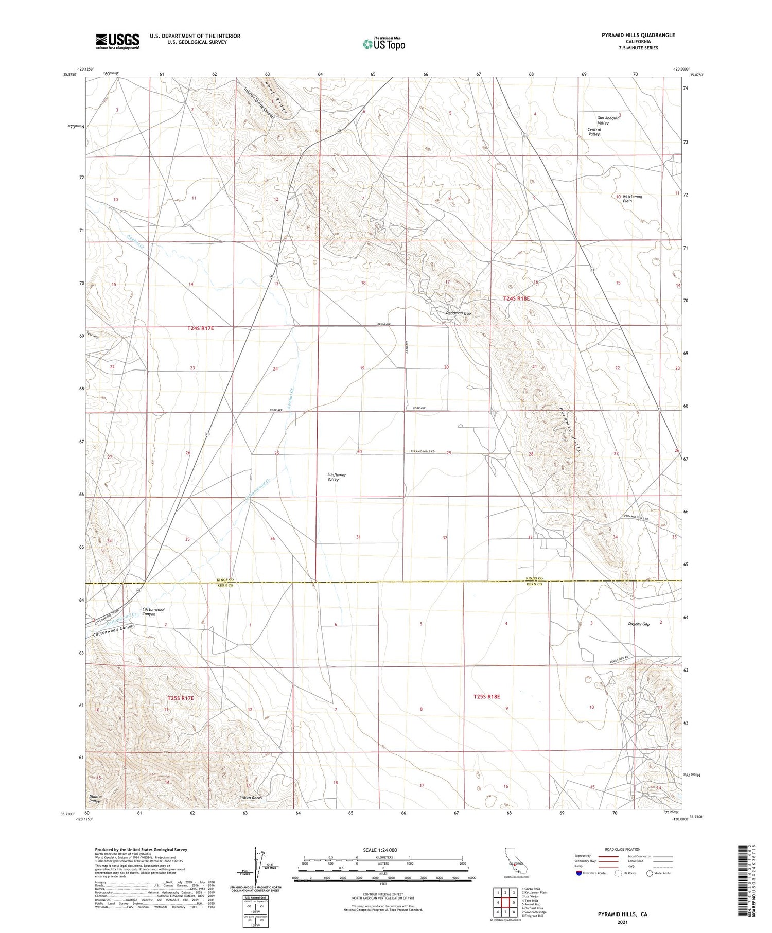
2021 topographic map quadrangle Pyramid Hills in the state of California. Scale: 1:24000. Based on the newly updated USGS 7.5' US Topo map series, this map is in the following counties: Kings, Kern. The map contains contour data, water features, and other items you are used to seeing on USGS maps, but also has updated roads and other features. This is the next generation of topographic maps. Printed on high-quality waterproof paper with UV fade-resistant inks.
Quads adjacent to this one:
West: Tent Hills
Northwest: Garza Peak
North: Kettleman Plain
Northeast: Los Viejos
East: Avenal Gap
Southeast: Emigrant Hill
South: Sawtooth Ridge
Southwest: Orchard Peak
This map covers the same area as the classic USGS quad with code o35120g1.
Contains the following named places: Arroyo Menudo, Avenal Creek, Cottonwood Canyon, Cottonwood Creek, Cottonwood Pumping Station, Dagany Gap, Deadman Gap, Devil Den, Devils Den Oil Field, Dudley Pump Station, Indian Rocks, Orchard Ranch, Pyramid Hills, Pyramid Hills Microwave Relay Station, Sulphur Spring Canyon, Sunflower Valley


