MyTopo
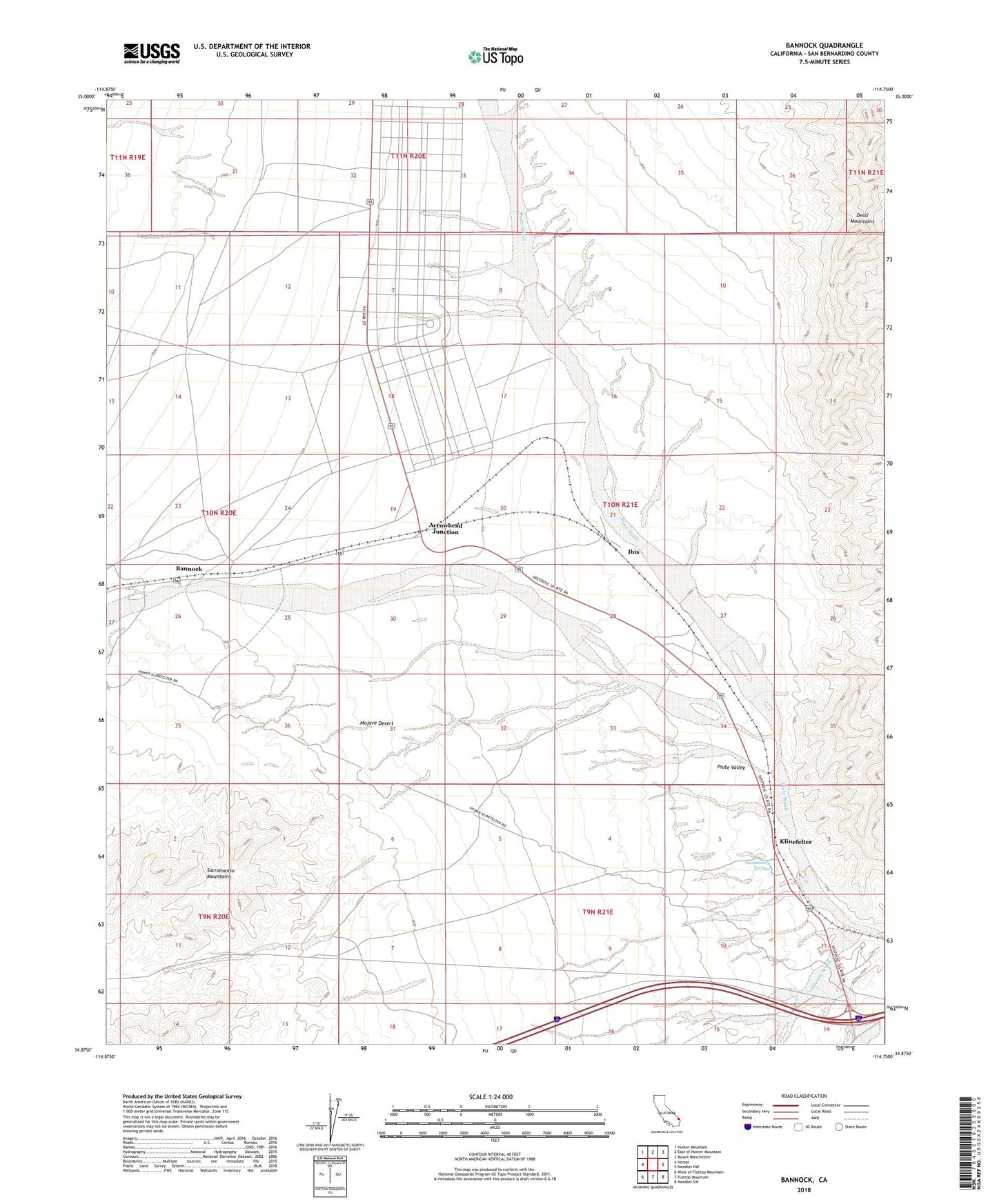
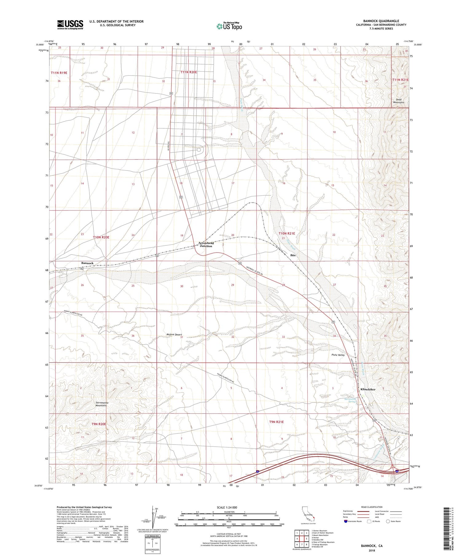
Bannock California US Topo Map
Couldn't load pickup availability
2021 topographic map quadrangle Bannock in the state of California. Scale: 1:24000. Based on the newly updated USGS 7.5' US Topo map series, this map is in the following counties: San Bernardino. The map contains contour data, water features, and other items you are used to seeing on USGS maps, but also has updated roads and other features. This is the next generation of topographic maps. Printed on high-quality waterproof paper with UV fade-resistant inks.
Quads adjacent to this one:
West: Homer
Northwest: Homer Mountain
North: East of Homer Mountain
Northeast: Mount Manchester
East: Needles NW
Southeast: Needles SW
South: Flattop Mountain
Southwest: West of Flattop Mountain
This map covers the same area as the classic USGS quad with code o34114h7.
Contains the following named places: Arrowhead Junction, Bannock, Camp Ibis, Camp Ibis Army Air Field, Crestview Wash, Ibis, Klinefelter, Sacramento Springs