MyTopo
West of Flattop Mountain California US Topo Map
Couldn't load pickup availability
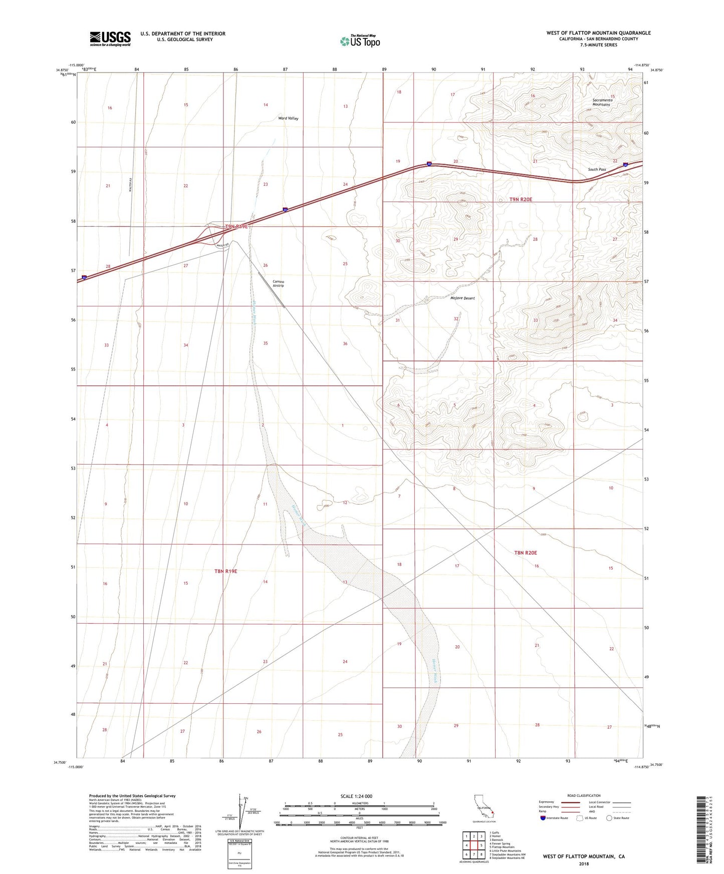
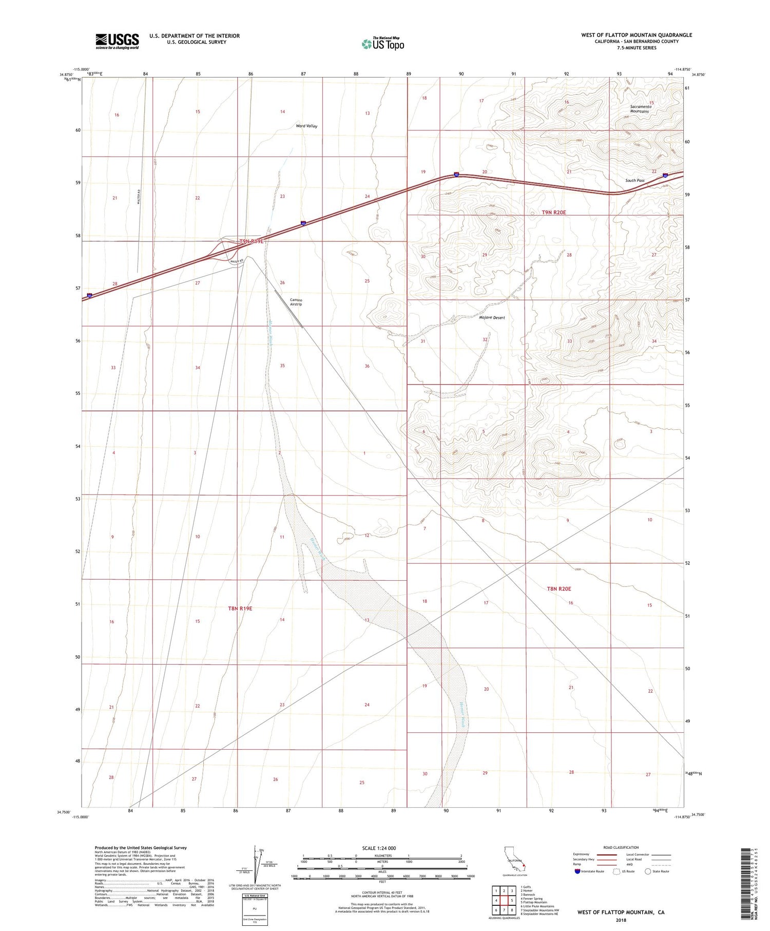
2021 topographic map quadrangle West of Flattop Mountain in the state of California. Scale: 1:24000. Based on the newly updated USGS 7.5' US Topo map series, this map is in the following counties: San Bernardino. The map contains contour data, water features, and other items you are used to seeing on USGS maps, but also has updated roads and other features. This is the next generation of topographic maps. Printed on high-quality waterproof paper with UV fade-resistant inks.
Quads adjacent to this one:
West: Fenner Spring
Northwest: Goffs
North: Homer
Northeast: Bannock
East: Flattop Mountain
Southeast: Stepladder Mountains NE
South: Stepladder Mountains NW
Southwest: Little Piute Mountains
This map covers the same area as the classic USGS quad with code o34114g8.
Contains the following named places: Bigelow Cholla Garden Wilderness, Camino Airstrip, South Pass