MyTopo
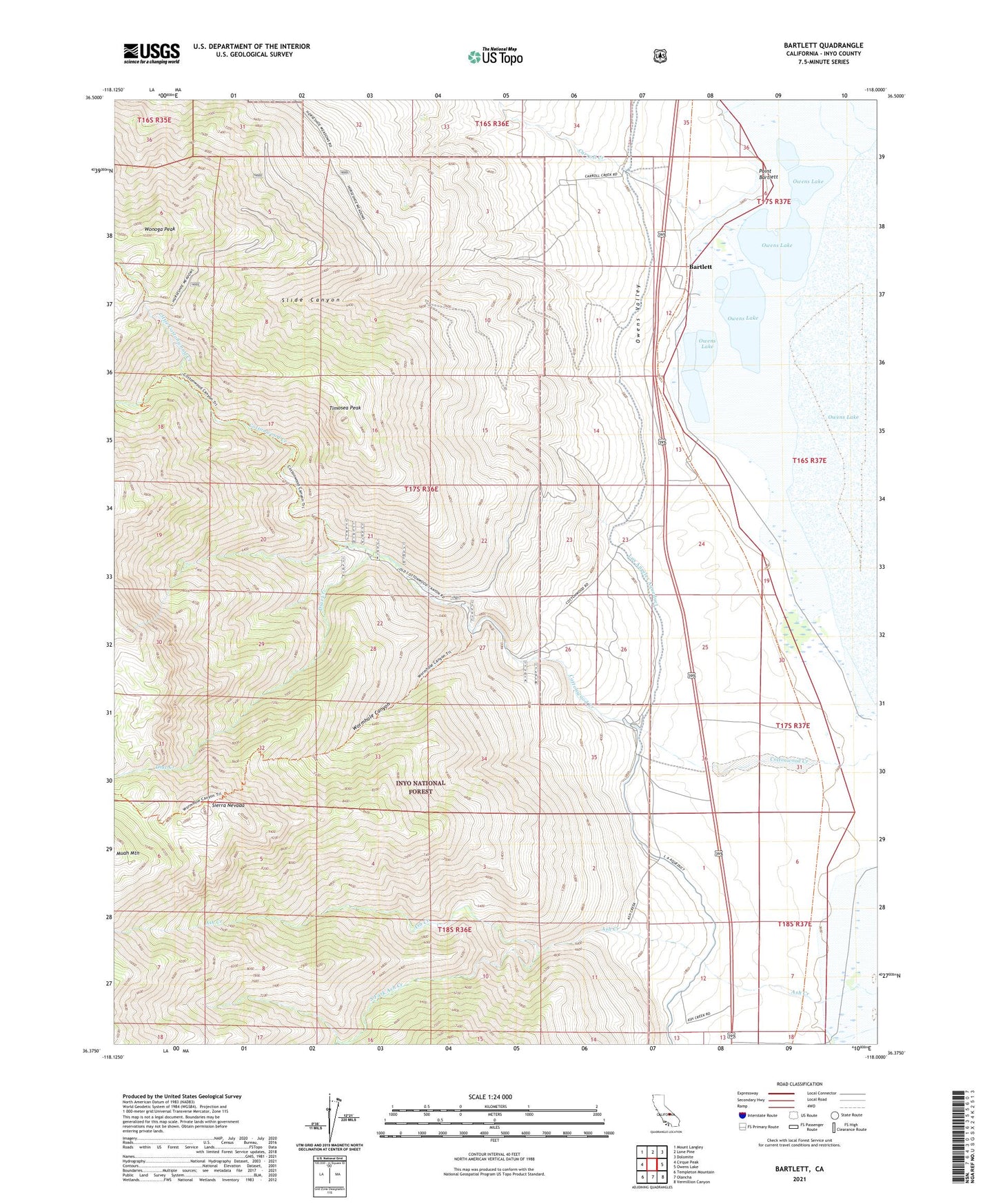
Bartlett California US Topo Map
Couldn't load pickup availability
Also explore the Bartlett Forest Service Topo of this same quad for updated USFS data
2021 topographic map quadrangle Bartlett in the state of California. Scale: 1:24000. Based on the newly updated USGS 7.5' US Topo map series, this map is in the following counties: Inyo. The map contains contour data, water features, and other items you are used to seeing on USGS maps, but also has updated roads and other features. This is the next generation of topographic maps. Printed on high-quality waterproof paper with UV fade-resistant inks.
Quads adjacent to this one:
West: Cirque Peak
Northwest: Mount Langley
North: Lone Pine
Northeast: Dolomite
East: Owens Lake
Southeast: Vermillion Canyon
South: Olancha
Southwest: Templeton Mountain
This map covers the same area as the classic USGS quad with code o36118d1.
Contains the following named places: Ash Creek, Bartlett, Carroll Creek, Cottonwood Creek, Cottonwood Materials Pit, Cottonwood Power Plant, Diaz Creek, Little Cottonwood Creek, Point Bartlett, Slide Canyon, South Fork Ash Creek, Timosea Peak, Wonoga Peak, Wormhole Canyon