MyTopo
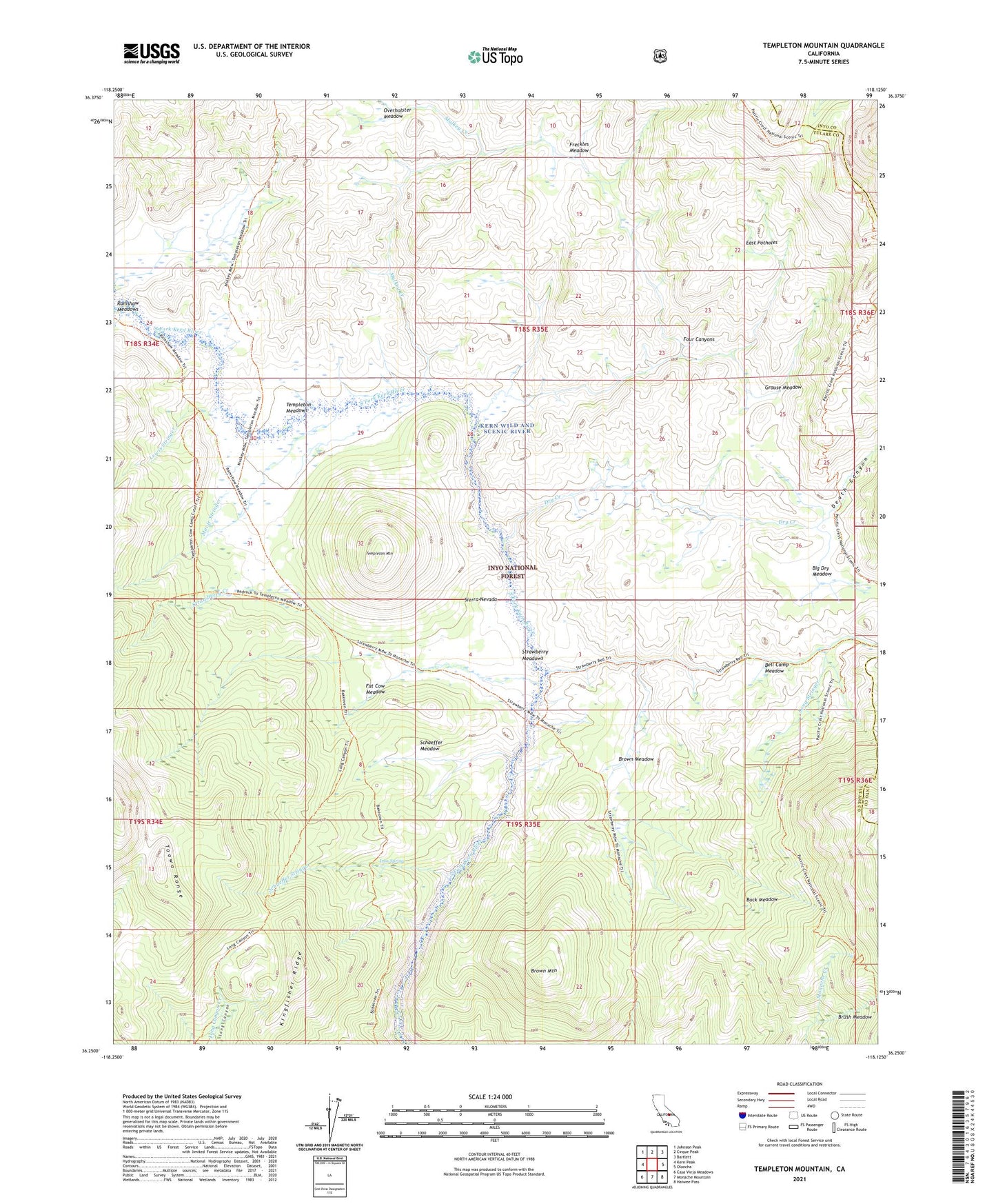
Templeton Mountain California US Topo Map
Couldn't load pickup availability
Also explore the Templeton Mountain Forest Service Topo of this same quad for updated USFS data
2021 topographic map quadrangle Templeton Mountain in the state of California. Scale: 1:24000. Based on the newly updated USGS 7.5' US Topo map series, this map is in the following counties: Tulare, Inyo. The map contains contour data, water features, and other items you are used to seeing on USGS maps, but also has updated roads and other features. This is the next generation of topographic maps. Printed on high-quality waterproof paper with UV fade-resistant inks.
Quads adjacent to this one:
West: Kern Peak
Northwest: Johnson Peak
North: Cirque Peak
Northeast: Bartlett
East: Olancha
Southeast: Haiwee Pass
South: Monache Mountain
Southwest: Casa Vieja Meadows
This map covers the same area as the classic USGS quad with code o36118c2.
Contains the following named places: Bell Camp Meadow, Big Dry Meadow, Brown Cow Camp, Brown Meadow, Brown Mountain, Brush Meadow, Buck Meadow, Death Canyon, Dry Creek, East Potholes, Fat Cow Meadow, Four Canyons, Freckles Meadow, Grouse Meadow, Iron Spring, Kingfisher Ridge, Lewis Stringer, Long Stringer, Movie Stringer, Mulkey Creek, Overholster Meadow, Schaeffer Meadow, Schaeffer Stringer, Strawberry Creek, Strawberry Meadows, Templeton Cow Camp, Templeton Meadows, Templeton Mountain