
MyTopo
Boron California US Topo Map
Couldn't load pickup availability
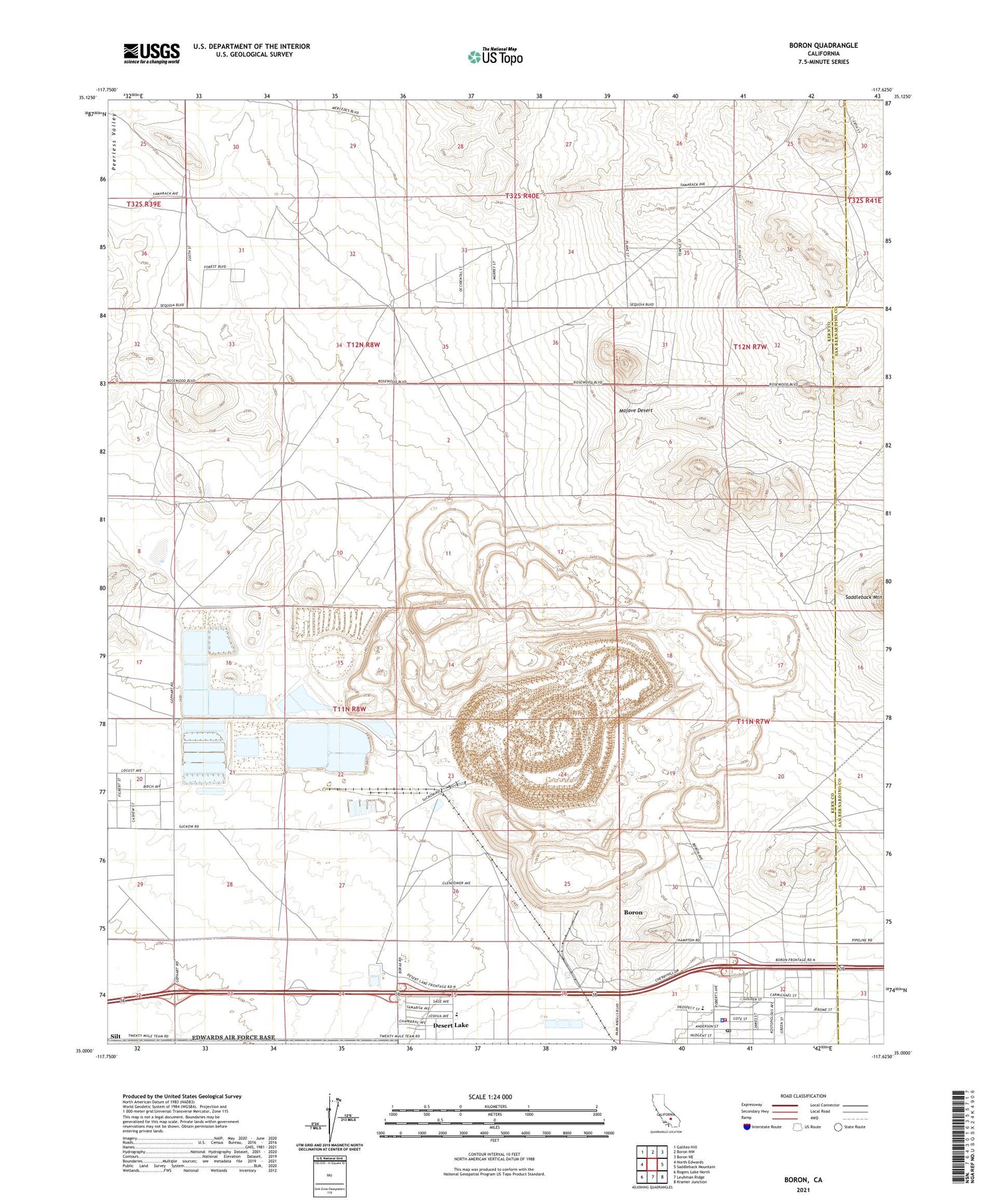
2021 topographic map quadrangle Boron in the state of California. Scale: 1:24000. Based on the newly updated USGS 7.5' US Topo map series, this map is in the following counties: Kern, San Bernardino. The map contains contour data, water features, and other items you are used to seeing on USGS maps, but also has updated roads and other features. This is the next generation of topographic maps. Printed on high-quality waterproof paper with UV fade-resistant inks.
Quads adjacent to this one:
West: North Edwards
Northwest: Galileo Hill
North: Boron NW
Northeast: Boron NE
East: Saddleback Mountain
Southeast: Kramer Junction
South: Leuhman Ridge
Southwest: Rogers Lake North
This map covers the same area as the classic USGS quad with code o35117a6.
Contains the following named places: Baker, Baker Mine, Borax Airport, Boron Census Designated Place, Boron Health Center, Boron Junior Senior High School, Boron Post Office, Boron T Pond 5 738-002 Dam, Boron T Pond 6 738-003 Dam, Boron Tailings Pd 738 Dam, Desert Lake, Gephart Junior High School, Jennifer Mine, Kern County Fire Department Station 17 Boron, Kern County Sheriff's Office, Rio Tinto Minerals - Boron Operations Emergency Medical Services, Russell Mine, Watershed Reservoir, West Baker, West Boron Elementary School, Western Mine, ZIP Code: 93516


