MyTopo
Cantil California US Topo Map
Couldn't load pickup availability
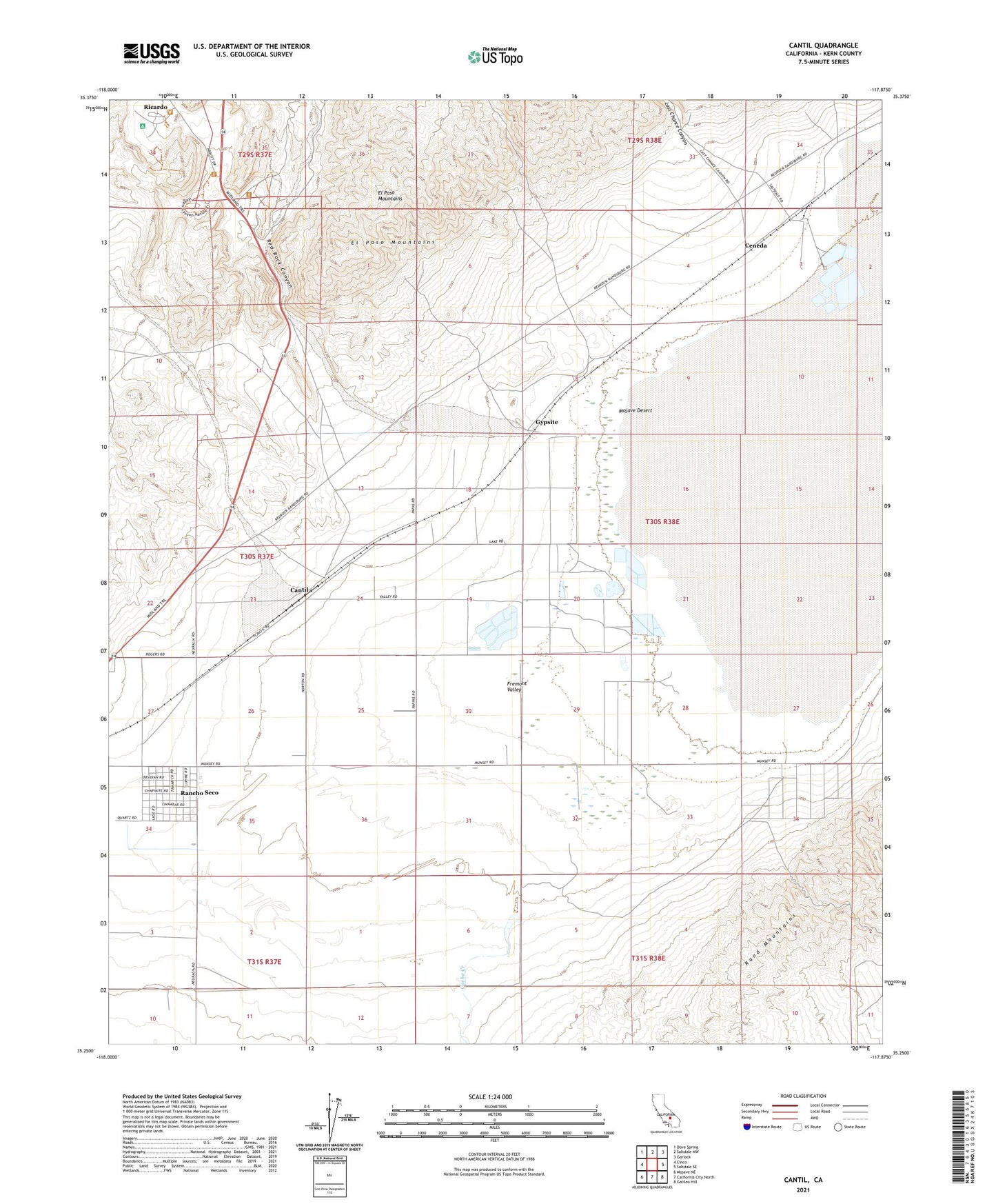
2021 topographic map quadrangle Cantil in the state of California. Scale: 1:24000. Based on the newly updated USGS 7.5' US Topo map series, this map is in the following counties: Kern. The map contains contour data, water features, and other items you are used to seeing on USGS maps, but also has updated roads and other features. This is the next generation of topographic maps. Printed on high-quality waterproof paper with UV fade-resistant inks.
Quads adjacent to this one:
West: Cinco
Northwest: Dove Spring
North: Saltdale NW
Northeast: Garlock
East: Saltdale SE
Southeast: Galileo Hill
South: California City North
Southwest: Mojave NE
This map covers the same area as the classic USGS quad with code o35117c8.
Contains the following named places: Bond Buyer Mine, Cache Creek, Cantil, Ceneda, Daley Mill, Daley Mine, Gypsite, Koehn Lake, Last Chance Canyon, Moore Ranch, Rancho Seco, Red Cliffs Natural Preserve, Red Rock Canyon, Red Rock Canyon State Park, Red Rock Elementary School, Redrock, Ricardo, Saltdale, ZIP Code: 93519