MyTopo
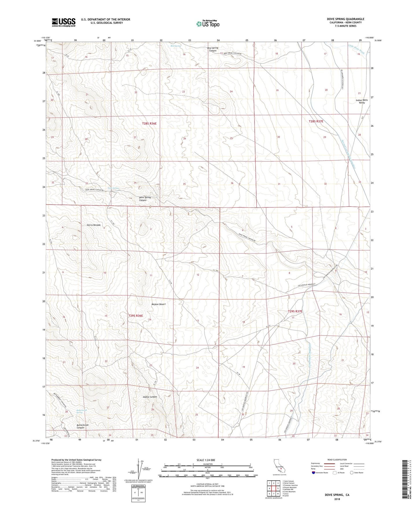
Dove Spring California US Topo Map
Couldn't load pickup availability
2021 topographic map quadrangle Dove Spring in the state of California. Scale: 1:24000. Based on the newly updated USGS 7.5' US Topo map series, this map is in the following counties: Kern. The map contains contour data, water features, and other items you are used to seeing on USGS maps, but also has updated roads and other features. This is the next generation of topographic maps. Printed on high-quality waterproof paper with UV fade-resistant inks.
Quads adjacent to this one:
West: Pinyon Mountain
Northwest: Cane Canyon
North: Horse Canyon
Northeast: Freeman Junction
East: Saltdale NW
Southeast: Cantil
South: Cinco
Southwest: Cross Mountain
This map covers the same area as the classic USGS quad with code o35118d1.
Contains the following named places: Bird Spring, Bird Spring Canyon, Bishops Claim, Butterbredt Spring, Dove Spring, Dove Spring Canyon, Dove Spring Mill, Dove Spring Ranch, Dove Well, Gold Peak Well, Granite King Mine, Little Dixie, Lone Star Mine, San Antonio Mine