MyTopo
Casmalia California US Topo Map
Couldn't load pickup availability
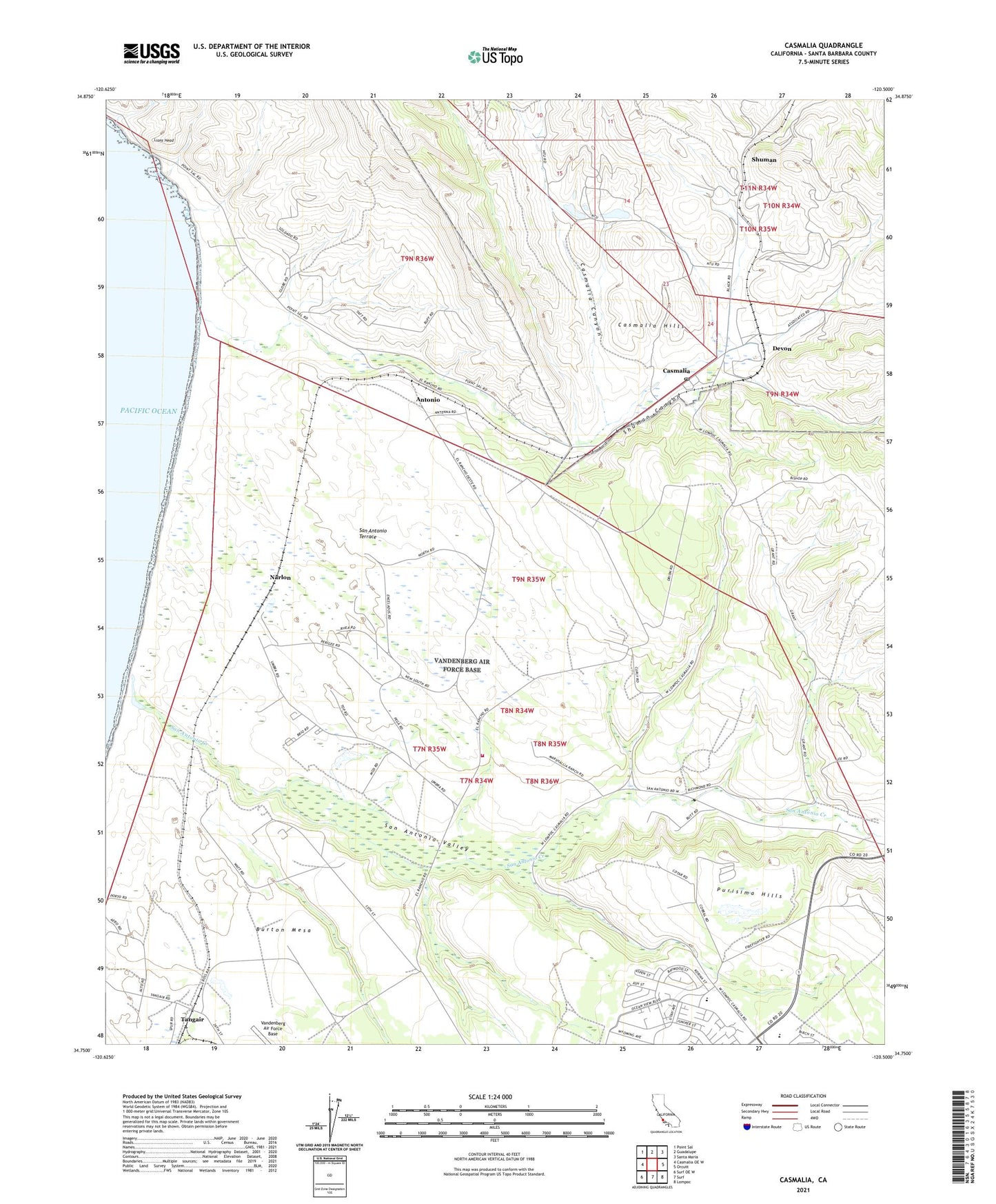
2021 topographic map quadrangle Casmalia in the state of California. Scale: 1:24000. Based on the newly updated USGS 7.5' US Topo map series, this map is in the following counties: Santa Barbara. The map contains contour data, water features, and other items you are used to seeing on USGS maps, but also has updated roads and other features. This is the next generation of topographic maps. Printed on high-quality waterproof paper with UV fade-resistant inks.
Quads adjacent to this one:
West: Casmalia OE W
Northwest: Point Sal
North: Guadalupe
Northeast: Santa Maria
East: Orcutt
Southeast: Lompoc
South: Surf
Southwest: Surf OE W
This map covers the same area as the classic USGS quad with code o34120g5.
Contains the following named places: Afrox Mine, Allan Hancock College - Vandenberg Air Force Base Center, Antonio, Casmalia, Casmalia Canyon, Casmalia Census Designated Place, Casmalia Oil Field, Casmalia Post Office, Crestview Elementary School, Devon, Jesus Maria, Lions Head, Marshallia Ranch, Narlon, Port Petrol, San Antonio Creek, San Antonio Terrace, San Antonio Valley, Shuman, Shuman Canyon, Space Launch Complex 10, Tangair, Vandenberg Air Force Base Fire Department Station 3, Vandenberg Middle School, Wollam Elementary School, ZIP Code: 93429