
MyTopo
Cayucos California US Topo Map
Couldn't load pickup availability
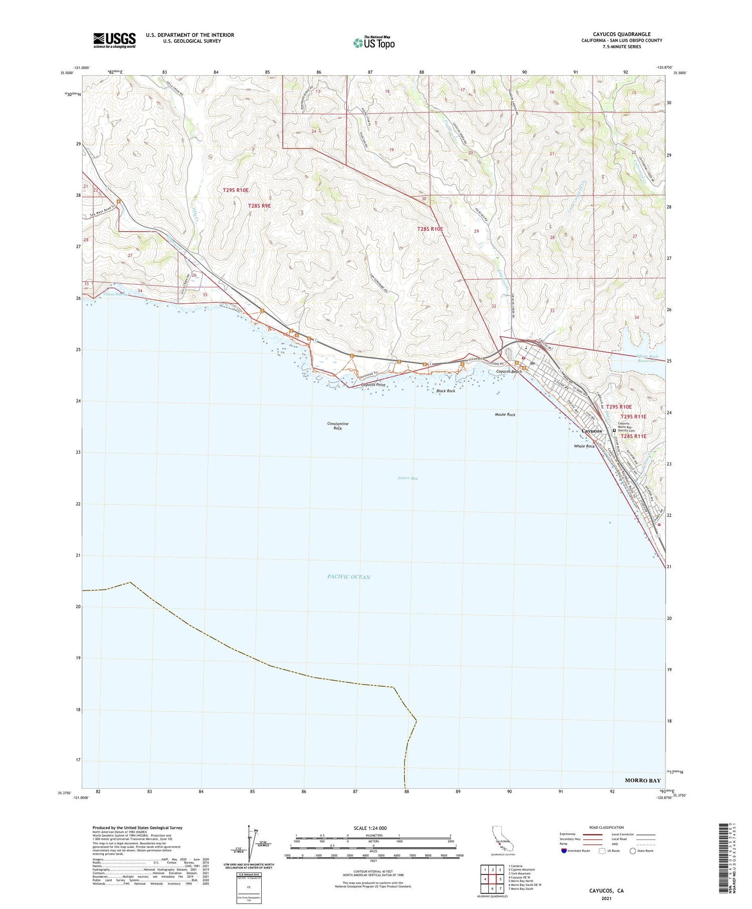
2021 topographic map quadrangle Cayucos in the state of California. Scale: 1:24000. Based on the newly updated USGS 7.5' US Topo map series, this map is in the following counties: San Luis Obispo. The map contains contour data, water features, and other items you are used to seeing on USGS maps, but also has updated roads and other features. This is the next generation of topographic maps. Printed on high-quality waterproof paper with UV fade-resistant inks.
Quads adjacent to this one:
West: Cayucos OE W
Northwest: Cambria
North: Cypress Mountain
Northeast: York Mountain
East: Morro Bay North
Southeast: Morro Bay South
South: Morro Bay South OE W
This map covers the same area as the classic USGS quad with code o35120d8.
Contains the following named places: Black Rock, CAL FIRE / San Luis Obispo County Fire Department Cayucos Station 11, CAL FIRE / San Luis Obispo County Fire Department Estero Bay Station 16, Cayucos, Cayucos Beach, Cayucos Branch San Luis Obispo City-County Library, Cayucos Census Designated Place, Cayucos Chamber of Commerce, Cayucos Church of Christ, Cayucos Community Church, Cayucos Creek, Cayucos Elementary School, Cayucos Pier, Cayucos Point, Cayucos Post Office, Cayucos State Beach, Cayucos-Morro Bay District Cemetery, China Harbor, Constantine Rock, Ellysly Creek, Estero Bay, Estero Bluffs State Park, Hardie Park, Harmony Headlands State Park, Little Cayucos Creek, Morro Strand State Beach, Mouse Rock, Old Creek, Saint Josephs Roman Catholic Church, San Geronimo, Someo School, Veterans Memorial Building, Villa Creek, Whale Rock, Whale Rock 1-040 Dam, Whale Rock Reservoir, Willow Creek, ZIP Code: 93430


