
MyTopo
Charleston School California US Topo Map
Couldn't load pickup availability
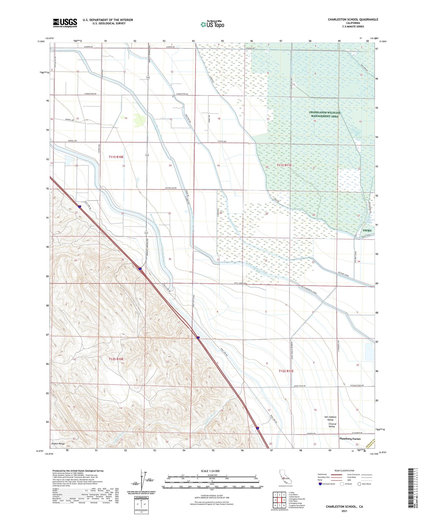
2021 topographic map quadrangle Charleston School in the state of California. Scale: 1:24000. Based on the newly updated USGS 7.5' US Topo map series, this map is in the following counties: Merced, Fresno. The map contains contour data, water features, and other items you are used to seeing on USGS maps, but also has updated roads and other features. This is the next generation of topographic maps. Printed on high-quality waterproof paper with UV fade-resistant inks.
Quads adjacent to this one:
West: Ortigalita Peak NW
Northwest: Volta
North: Los Banos
Northeast: Delta Ranch
East: Dos Palos
Southeast: Hammonds Ranch
South: Laguna Seca Ranch
Southwest: Ortigalita Peak
This map covers the same area as the classic USGS quad with code o36120h7.
Contains the following named places: Brito Gun Club, Camp 13, Camp Thirteen Slough, Charieston Elementary School, Dos Amigos Management Area, Dos Amigos Pumping Plant, Gadwall Canal, Hamburg Farms, Hamburg Ranch School, Laguna Seca Creek, Outside Canal, Santa Cruz Gun Club, Sportsmens Gun Club, Woo Ranch


