
MyTopo
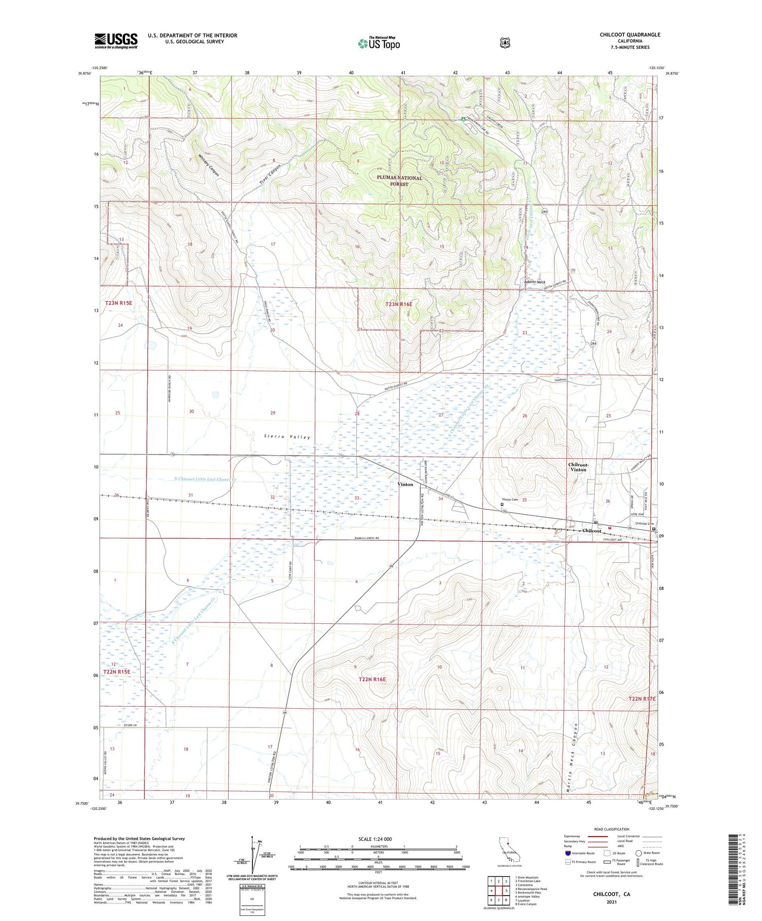
Chilcoot California US Topo Map
Couldn't load pickup availability
Also explore the Chilcoot Forest Service Topo of this same quad for updated USFS data
2021 topographic map quadrangle Chilcoot in the state of California. Scale: 1:24000. Based on the newly updated USGS 7.5' US Topo map series, this map is in the following counties: Plumas, Lassen. The map contains contour data, water features, and other items you are used to seeing on USGS maps, but also has updated roads and other features. This is the next generation of topographic maps. Printed on high-quality waterproof paper with UV fade-resistant inks.
Quads adjacent to this one:
West: Reconnaissance Peak
Northwest: Dixie Mountain
North: Frenchman Lake
Northeast: Constantia
East: Beckwourth Pass
Southeast: Evans Canyon
South: Loyalton
Southwest: Antelope Valley
This map covers the same area as the classic USGS quad with code o39120g2.
Contains the following named places: Adams Neck, Chilcoot, Chilcoot Campground, Chilcoot Cemetery, Chilcoot Post Office, Chilcoot-Vinton Census Designated Place, Dyson Slough, Little Last Chance Canyon Special Interest Area, Little Last Chance Creek, Martin Neck Canyon, Sierra Valley Fire Protection District, Summit School, Trosi Canyon, Trosi Canyon Ranch, Vinton, Vinton Cemetery, Whiskey Canyon, ZIP Code: 96135


