MyTopo
Chittenden California US Topo Map
Couldn't load pickup availability
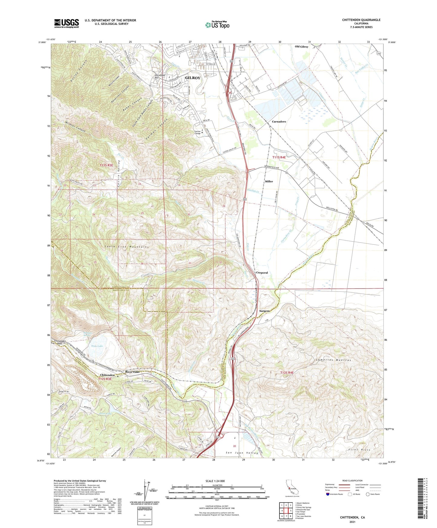
2021 topographic map quadrangle Chittenden in the state of California. Scale: 1:24000. Based on the newly updated USGS 7.5' US Topo map series, this map is in the following counties: Santa Clara, San Benito, Santa Cruz. The map contains contour data, water features, and other items you are used to seeing on USGS maps, but also has updated roads and other features. This is the next generation of topographic maps. Printed on high-quality waterproof paper with UV fade-resistant inks.
Quads adjacent to this one:
West: Watsonville East
Northwest: Mount Madonna
North: Gilroy
Northeast: Gilroy Hot Springs
East: San Felipe
Southeast: Hollister
South: San Juan Bautista
Southwest: Prunedale
This map covers the same area as the classic USGS quad with code o36121h5.
Contains the following named places: Anzar High School, Anzar Lake, Babbs Canyon, Betabel, Carlyle Hills, Carnadero, Carnadero Creek, Carnadero School, Castro Valley, Chittenden, Christmas Hill, Corporal, Dexter Creek, El Pajaro Springs, Farman Canyon, Fep, Gavilan College Golf Course, Gavilan College Library, Gavilan College Main Campus, Gavilan Creek, Gavilan Hills Academy, Gilroy Early College Academy, Gilroy High School, Gilroy Wastewater Treatment Plant, Jones Creek, Jurista, Las Animas, Las Animas Elementary School, Llagas Creek, Lomerias Muertas, McCutchin Canyon, Miller, Miller Slough, Nema, Old Gilroy, Pescadero Creek, Plantel, Quarry Lake, Reservoir Canyon, River Oaks, San Benito River, San Benito Valley, San Juan Valley, San Ysidro, San Ysidro Creek, Sargent, Sargent Creek, Sargent Hills, Sargent Oil Field, Sawyers Crossing, Soda Lake, Soda Lake 636 Dam, South Fork Babbs Canyon, Star Creek, Sunnybrook School, Tar Creek, Tick Creek, Uvas Creek, Wildcat Canyon, Z - Best Composting Facility