MyTopo
Watsonville East California US Topo Map
Couldn't load pickup availability
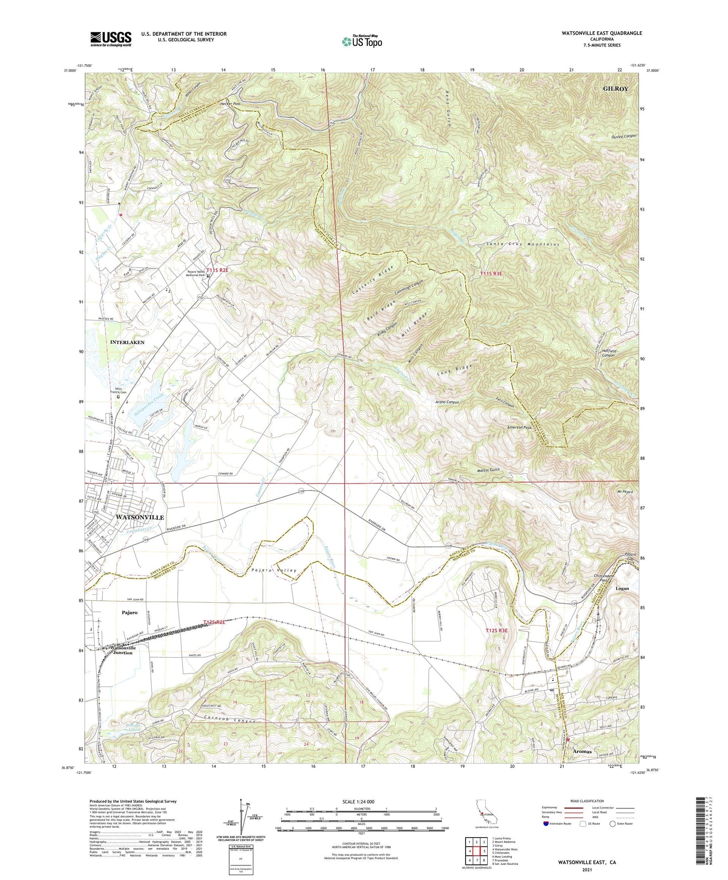
2021 topographic map quadrangle Watsonville East in the state of California. Scale: 1:24000. Based on the newly updated USGS 7.5' US Topo map series, this map is in the following counties: Santa Cruz, Monterey, Santa Clara, San Benito. The map contains contour data, water features, and other items you are used to seeing on USGS maps, but also has updated roads and other features. This is the next generation of topographic maps. Printed on high-quality waterproof paper with UV fade-resistant inks.
Quads adjacent to this one:
West: Watsonville West
Northwest: Loma Prieta
North: Mount Madonna
Northeast: Gilroy
East: Chittenden
Southeast: San Juan Bautista
South: Prunedale
Southwest: Moss Landing
This map covers the same area as the classic USGS quad with code o36121h6.
Contains the following named places: Alianza Charter School, Ann Soldo Elementary School, Arano Canyon, Aromas, Aromas Branch Monterey County Free Libraries, Aromas Census Designated Place, Aromas Community Park, Aromas Elementary School, Aromas Post Office, Assumption Catholic Church, Atherton Peak, Atri Park, Bald Ridge, Banks Canyon, Calvary Christian Center, Carlton School, Casserly Creek, Casserly Ridge, Casserly School, Chittenden Pass, Church of Jesus Christ Temple Bethany Church, College Lake, Community Baptist Church of Aromas, Corncob Canyon, Corralitos Creek, Coward Creek, Cummings Canyon, Department of Forestry and Fire Protection Aromas Tri - County Fire District, Department of Forestry and Fire Protection Pajaro Valley, Drew Lake, East Lake Village Shopping Center, Fern Canyon, Gaffey Creek, Glaum Egg Ranch, Good Samaritan Church of God in Christ, Hatfield Canyon, Hecker Pass, Hughes Creek, Interlaken, Interlaken Census Designated Place, Johnston Corner, Kelly Lake, Kinky Canyon, Lake Tynan, Lakeview Middle School, Linear Park, Logan, Long Ridge, Mattos Gulch, Mill Canyon, Mill Ridge, Mount Pajaro, Murphy Crossing, Ohlone Elementary School, Our Lady Help of Christians Valley Roman Catholic Church, Pajaro, Pajaro Census Designated Place, Pajaro Gap, Pajaro Middle School, Pajaro Mobile Manor, Pajaro Valley Memorial Park, Pentecostal Holiness Church, Railroad School, Rose Reservoir, Saint Francis Cemetery, Saint Francis High School, Saint Francis Orphan Asylum, Salsipuedes, Salsipuedes Creek, Salsipuedes Elementary School, Santa Cruz County Fairgrounds, Simas Lake, Spring Hills Golf Club, Thompsons Grove, Valley Catholic Church, Vega, Vega Del Rio Del Pajaro, Vega School, Warner Lake, Watsonville Buddhist Temple, Watsonville Charter School of the Arts, Watsonville Junction