MyTopo
Chloride City California US Topo Map
Couldn't load pickup availability
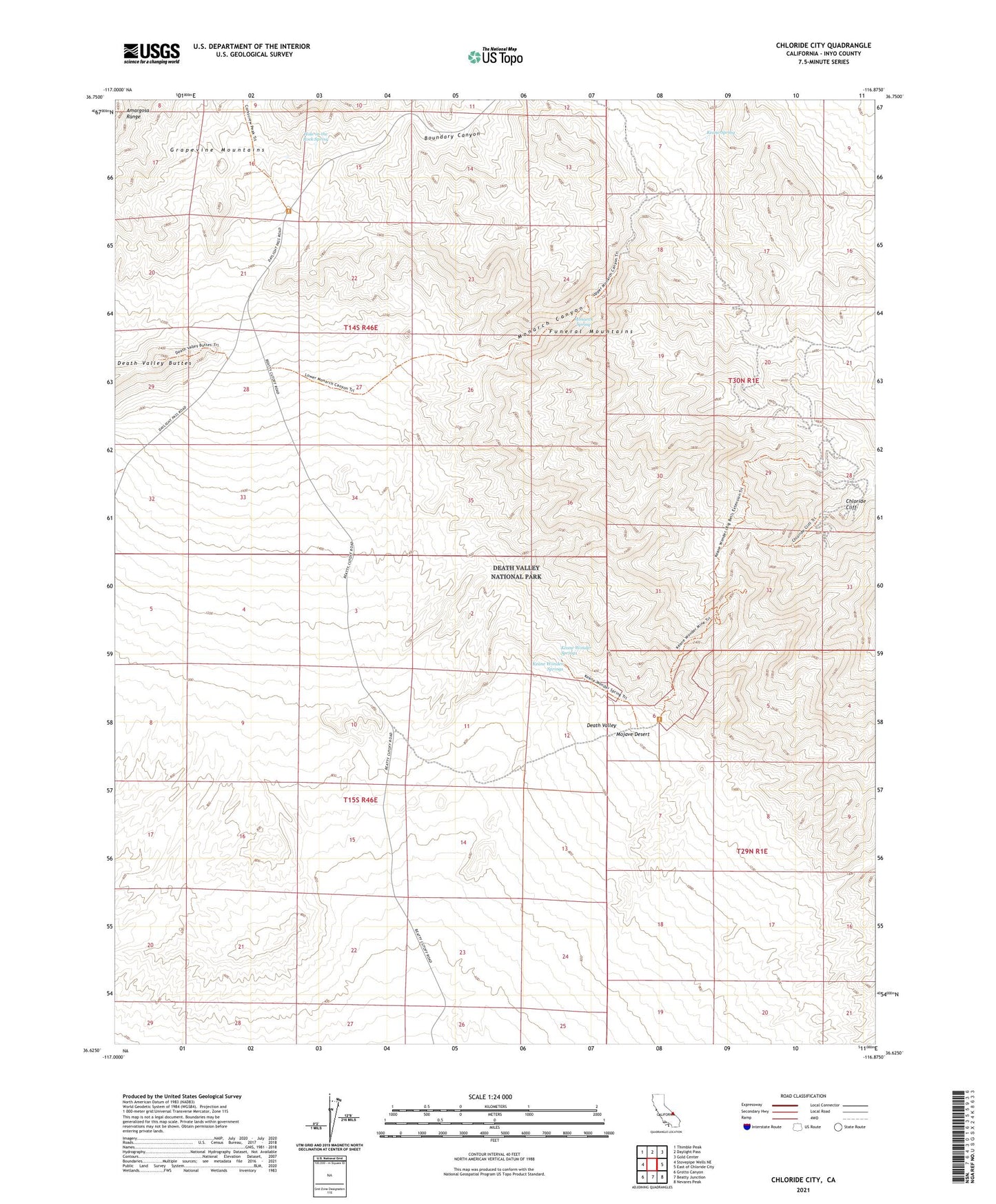
2021 topographic map quadrangle Chloride City in the state of California. Scale: 1:24000. Based on the newly updated USGS 7.5' US Topo map series, this map is in the following counties: Inyo. The map contains contour data, water features, and other items you are used to seeing on USGS maps, but also has updated roads and other features. This is the next generation of topographic maps. Printed on high-quality waterproof paper with UV fade-resistant inks.
Quads adjacent to this one:
West: Stovepipe Wells NE
Northwest: Thimble Peak
North: Daylight Pass
Northeast: Gold Center
East: East of Chloride City
Southeast: Nevares Peak
South: Beatty Junction
Southwest: Grotto Canyon
This map covers the same area as the classic USGS quad with code o36116f8.
Contains the following named places: Big Bell Mine, Boundary Canyon, Chloride City, Chloride Cliff, Hole-in-the Rock Spring, Keane Spring, Keane Wonder Mill, Keane Wonder Mine, Keane Wonder Springs, Monarch Canyon, Monarch Spring