MyTopo
Stovepipe Wells NE California US Topo Map
Couldn't load pickup availability
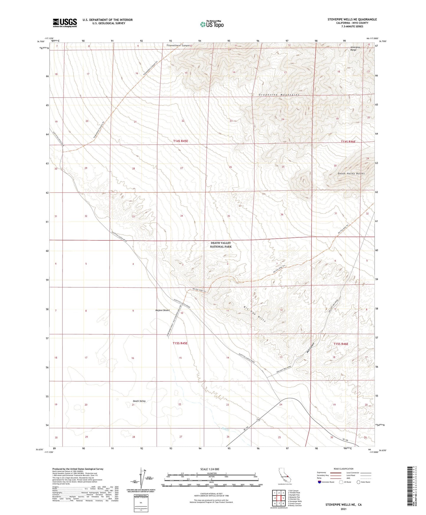
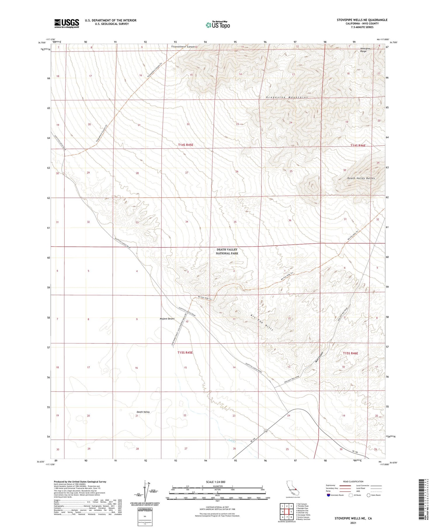
2021 topographic map quadrangle Stovepipe Wells NE in the state of California. Scale: 1:24000. Based on the newly updated USGS 7.5' US Topo map series, this map is in the following counties: Inyo. The map contains contour data, water features, and other items you are used to seeing on USGS maps, but also has updated roads and other features. This is the next generation of topographic maps. Printed on high-quality waterproof paper with UV fade-resistant inks.
Quads adjacent to this one:
West: Mesquite Flat
Northwest: Fall Canyon
North: Thimble Peak
Northeast: Daylight Pass
East: Chloride City
Southeast: Beatty Junction
South: Grotto Canyon
Southwest: Stovepipe Wells
Contains the following named places: Death Valley Buttes, Kit Fox Hills, Mud Canyon, Stovepipe Wells, Titanothere Canyon