MyTopo
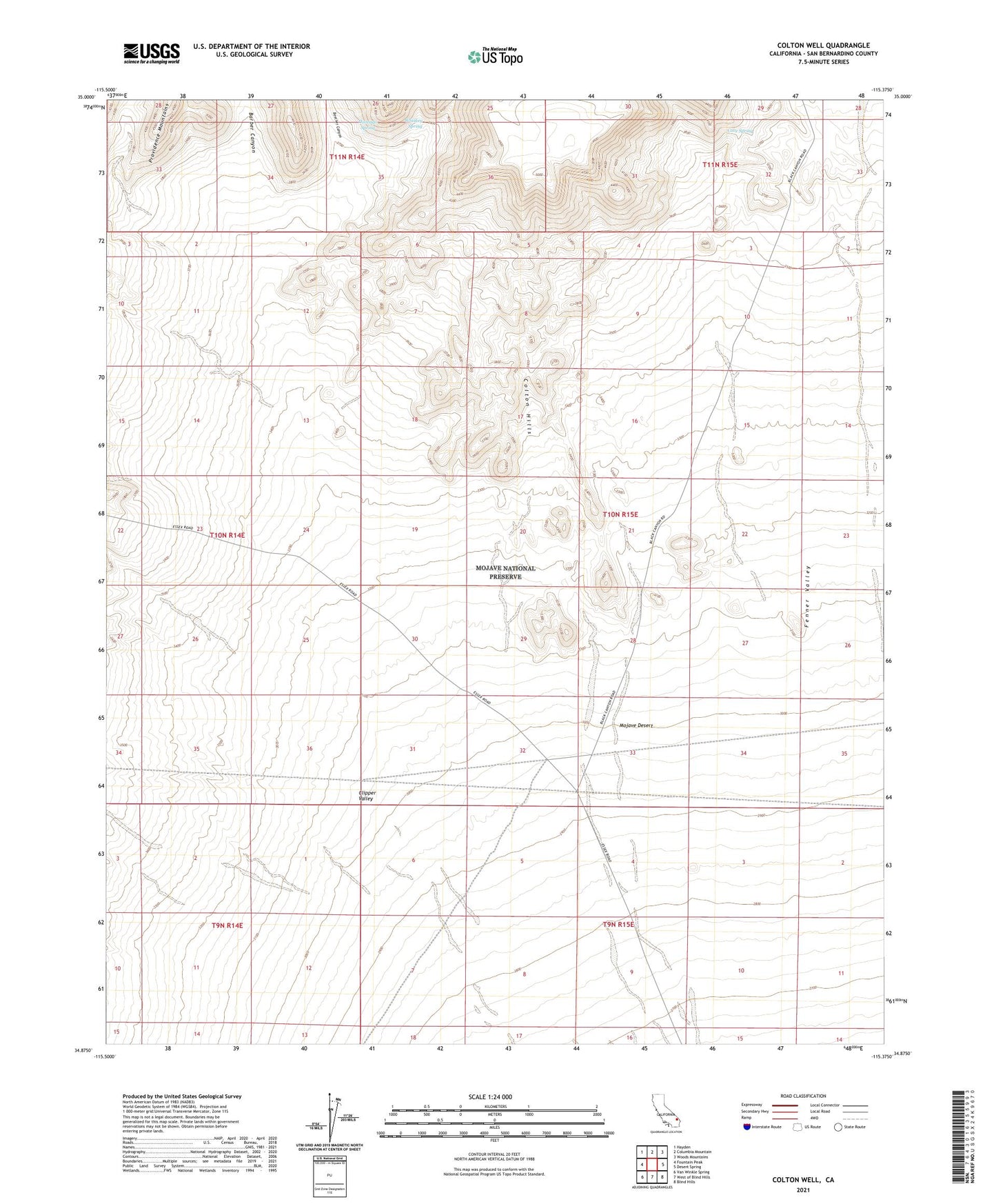
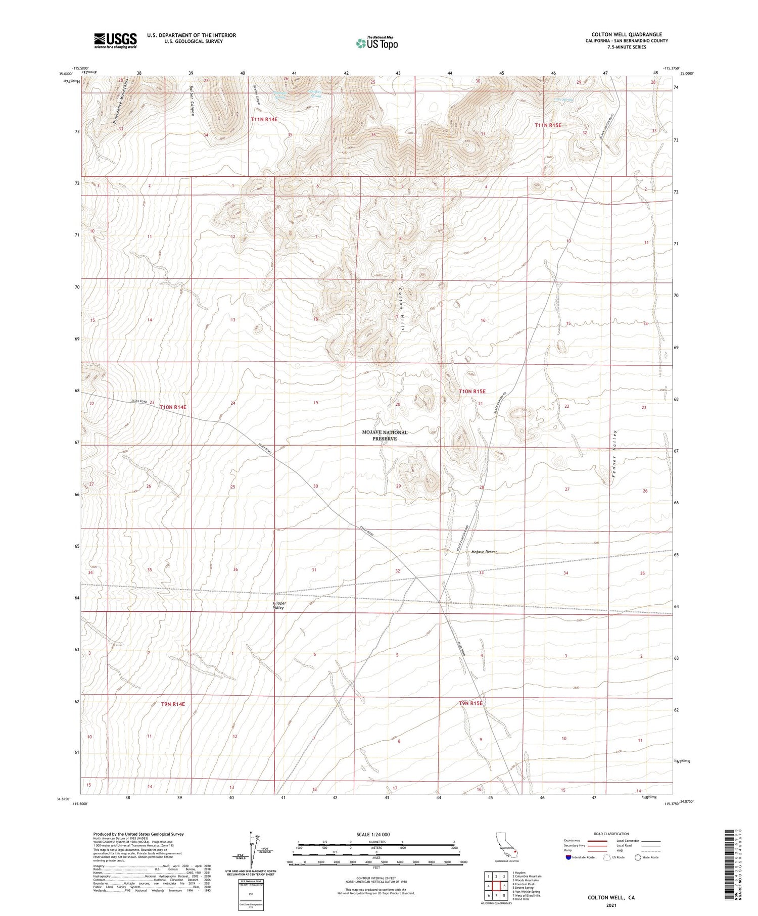
Colton Well California US Topo Map
Couldn't load pickup availability
2021 topographic map quadrangle Colton Well in the state of California. Scale: 1:24000. Based on the newly updated USGS 7.5' US Topo map series, this map is in the following counties: San Bernardino. The map contains contour data, water features, and other items you are used to seeing on USGS maps, but also has updated roads and other features. This is the next generation of topographic maps. Printed on high-quality waterproof paper with UV fade-resistant inks.
Quads adjacent to this one:
West: Fountain Peak
Northwest: Hayden
North: Columbia Mountain
Northeast: Woods Mountains
East: Desert Spring
Southeast: Blind Hills
South: West of Blind Hills
Southwest: Van Winkle Spring
This map covers the same area as the classic USGS quad with code o34115h4.
Contains the following named places: Barber Canyon, Bearclaw Well, Beecher Canyon, Bonanza King Well, Cave Spring, Colton Hills, Colton Well, Domingo Spring, Seven IL Ranch, Silver King Mine, Whiskey Spring