MyTopo
Columbia Mountain California US Topo Map
Couldn't load pickup availability
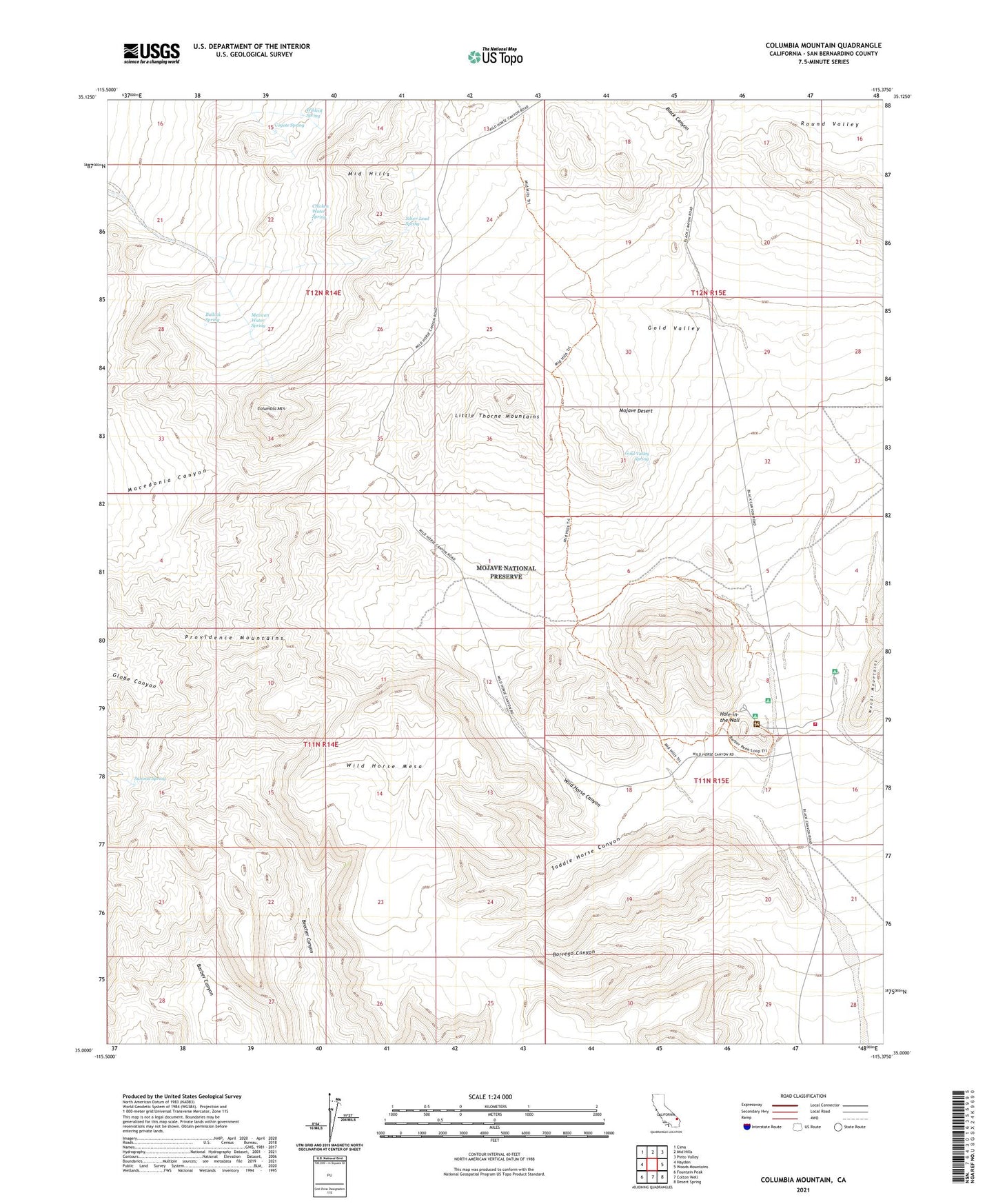
2021 topographic map quadrangle Columbia Mountain in the state of California. Scale: 1:24000. Based on the newly updated USGS 7.5' US Topo map series, this map is in the following counties: San Bernardino. The map contains contour data, water features, and other items you are used to seeing on USGS maps, but also has updated roads and other features. This is the next generation of topographic maps. Printed on high-quality waterproof paper with UV fade-resistant inks.
Quads adjacent to this one:
West: Hayden
Northwest: Cima
North: Mid Hills
Northeast: Pinto Valley
East: Woods Mountains
Southeast: Desert Spring
South: Colton Well
Southwest: Fountain Peak
This map covers the same area as the classic USGS quad with code o35115a4.
Contains the following named places: Barber Well, Black Canyon, Borrego Canyon, Bullock Spring, Chicken Water Spring, Columbia Mine, Columbia Mountain, Coyote Spring, Globe Mine, Gold Valley, Gold Valley Mine, Gold Valley Spring, Granite Well, Hole-in-the Wall, Hole-in-the-Wall Campground, Little Thorne Mountains, Mexican Water Spring, Saddle Horse Canyon, Silver Lead Spring, Summit Spring, Wild Horse Canyon, Wild Horse Mesa, Wildcat Spring, Willow Well