MyTopo
Cross Roads California US Topo Map
Couldn't load pickup availability
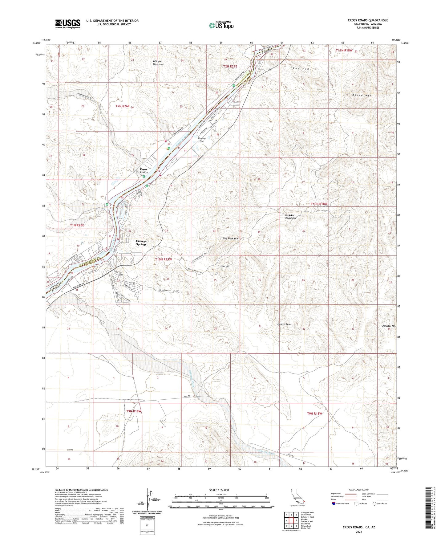
2021 topographic map quadrangle Cross Roads in the states of Arizona, California. Scale: 1:24000. Based on the newly updated USGS 7.5' US Topo map series, this map is in the following counties: San Bernardino, La Paz. The map contains contour data, water features, and other items you are used to seeing on USGS maps, but also has updated roads and other features. This is the next generation of topographic maps. Printed on high-quality waterproof paper with UV fade-resistant inks.
Quads adjacent to this one:
West: Parker
Northwest: Whipple Wash
North: Gene Wash
Northeast: Monkeys Head
East: Osborne Well
Southeast: Bobs Well
South: Black Peak
Southwest: Parker SE
This map covers the same area as the classic USGS quad with code o34114b2.
Contains the following named places: Ah Villa Park, Bennett Wash, Billy Mack Mine, Billy Mack Mountain, Bowmans Wash, Bransons Mobile Home Park, Buckskin Fire Department Station 11, Carnation Mine, Christ's Church on the River, Cienega Springs, Cienega Springs Census Designated Place, Copper Basin Wash, Cross Roads, Eagle Wash, Eagles Nest Mine, Emerald Canyon Golf Course, Empire Flat, Giers Mountain, Gray Eagle Mine, Lion Hill, Osborne Wash, Parker Strip, Red Mountain, Rio Vista Mine, San Bernardino County Fire Department Station 21 Parker Strip, Sandbar Resort Red Rock Campgrounds, Sue Mine