MyTopo
Monkeys Head Arizona US Topo Map
Couldn't load pickup availability
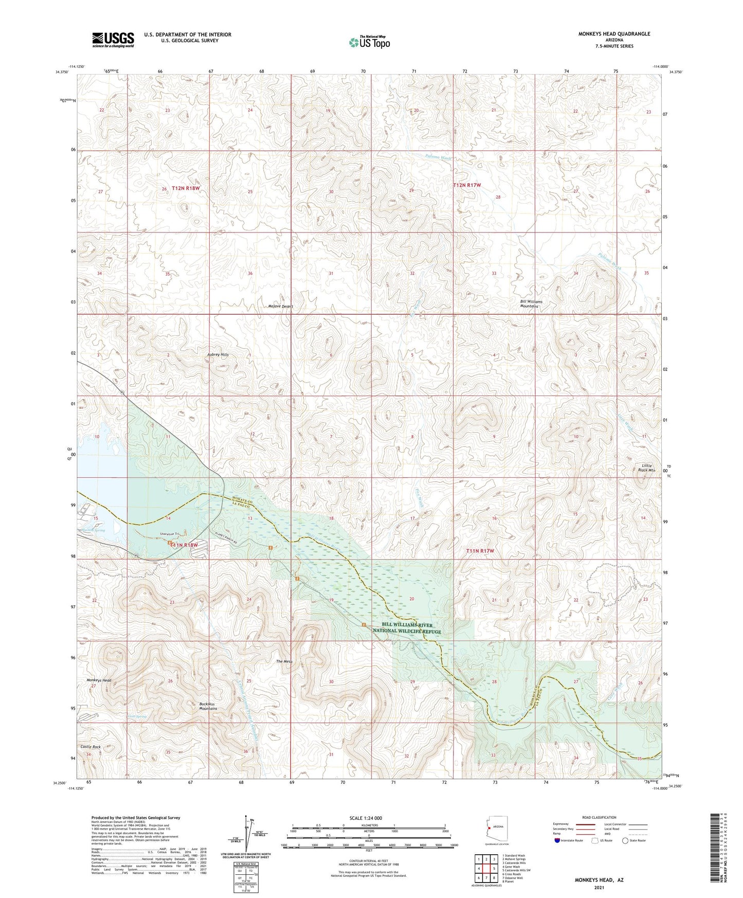
2021 topographic map quadrangle Monkeys Head in the state of Arizona. Scale: 1:24000. Based on the newly updated USGS 7.5' US Topo map series, this map is in the following counties: Mohave, La Paz. The map contains contour data, water features, and other items you are used to seeing on USGS maps, but also has updated roads and other features. This is the next generation of topographic maps. Printed on high-quality waterproof paper with UV fade-resistant inks.
Quads adjacent to this one:
West: Gene Wash
Northwest: Standard Wash
North: Mohave Springs
Northeast: Castaneda Hills
East: Castaneda Hills SW
Southeast: Planet
South: Osborne Well
Southwest: Cross Roads
This map covers the same area as the classic USGS quad with code o34114c1.
Contains the following named places: Aubrey Landing, Bill Williams Mountains, Bill Williams River National Wildlife Refuge, Bucksin Mountain State Park, Castle Rock, Cave Wash, Central Arizona Project Aqueduct, Fox Wash, Goat Spring, Havasu National Wildlife Refuge, Havasu Spring, Kohen Ranch, Larneds Landing, Little Black Mountain, Mineral Wash, Monkeys Head, Paloma Prospect, Ramon Esquerra Ranch, The Mesa