MyTopo
Echo Canyon California US Topo Map
Couldn't load pickup availability
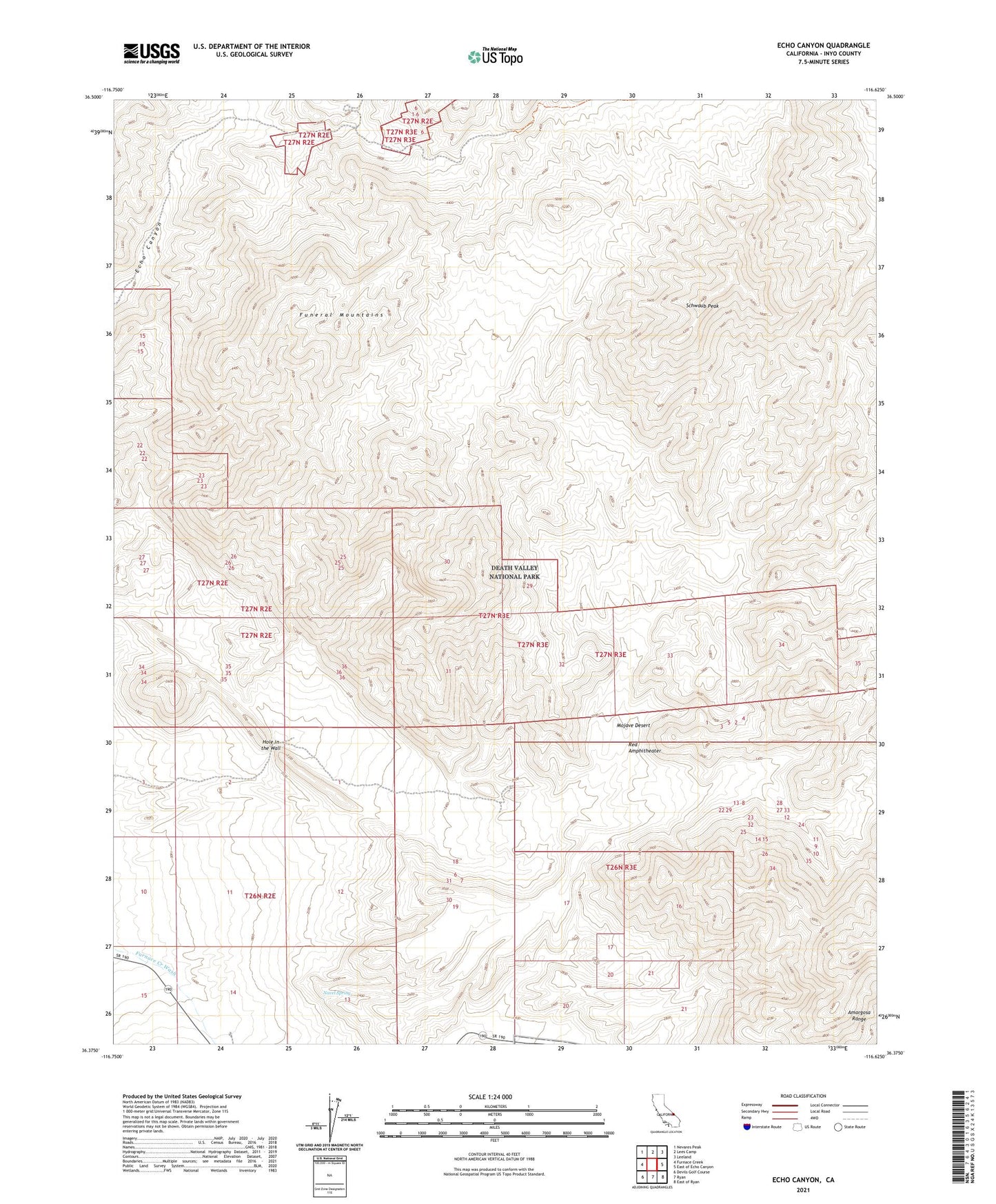
2021 topographic map quadrangle Echo Canyon in the state of California. Scale: 1:24000. Based on the newly updated USGS 7.5' US Topo map series, this map is in the following counties: Inyo. The map contains contour data, water features, and other items you are used to seeing on USGS maps, but also has updated roads and other features. This is the next generation of topographic maps. Printed on high-quality waterproof paper with UV fade-resistant inks.
Quads adjacent to this one:
West: Furnace Creek
Northwest: Nevares Peak
North: Lees Camp
Northeast: Leeland
East: East of Echo Canyon
Southeast: East of Ryan
South: Ryan
Southwest: Devils Golf Course
This map covers the same area as the classic USGS quad with code o36116d6.
Contains the following named places: Hole in the Wall, Inyo Mine, Navel Spring, Red Amphitheater, Schwaub Peak