MyTopo
Furnace Creek California US Topo Map
Couldn't load pickup availability
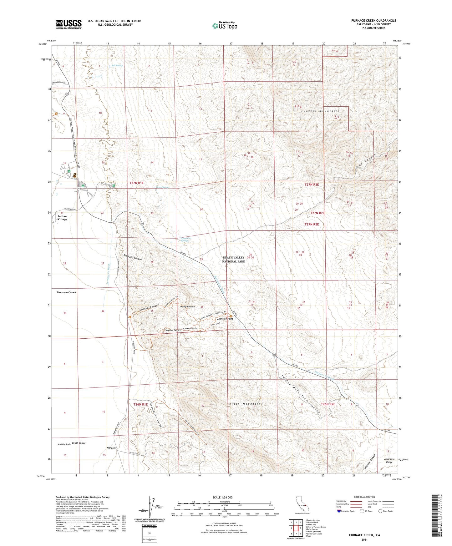
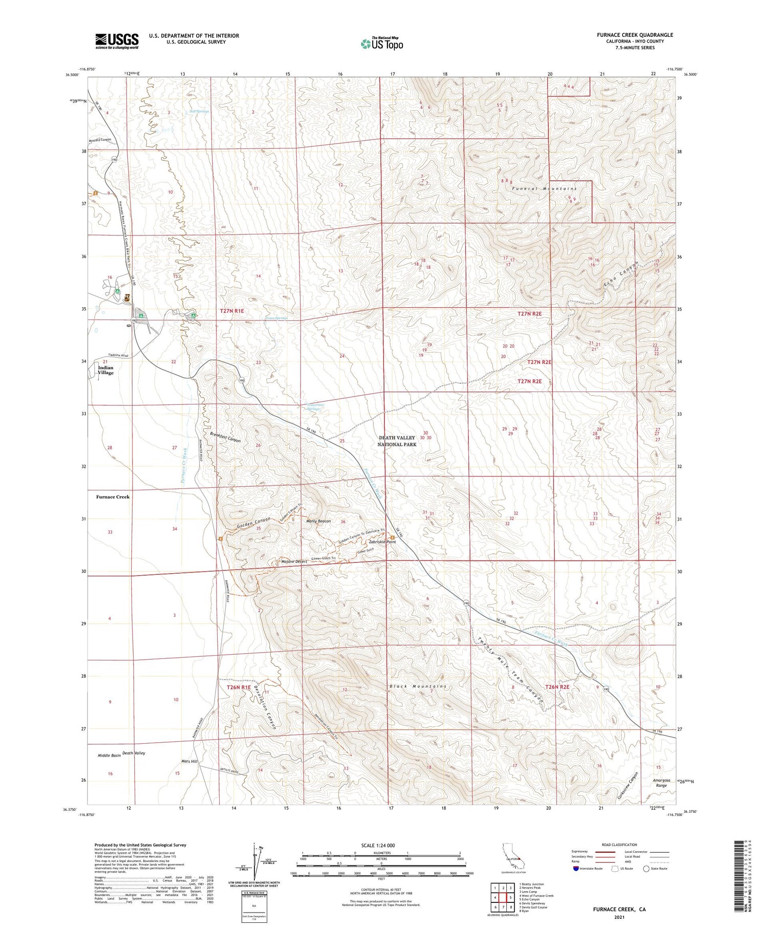
2021 topographic map quadrangle Furnace Creek in the state of California. Scale: 1:24000. Based on the newly updated USGS 7.5' US Topo map series, this map is in the following counties: Inyo. The map contains contour data, water features, and other items you are used to seeing on USGS maps, but also has updated roads and other features. This is the next generation of topographic maps. Printed on high-quality waterproof paper with UV fade-resistant inks.
Quads adjacent to this one:
West: West of Furnace Creek
Northwest: Beatty Junction
North: Nevares Peak
Northeast: Lees Camp
East: Echo Canyon
Southeast: Ryan
South: Devils Golf Course
Southwest: Devils Speedway
This map covers the same area as the classic USGS quad with code o36116d7.
Contains the following named places: Breakfast Canyon, Corkscrew Canyon, Cow Creek, Death Valley, Death Valley National Park Fire and Rescue, Death Valley National Park Visitor Center, Death Valley Post Office, Desolation Canyon, East Coleman Pit, Echo Canyon, Furnace Creek, Furnace Creek Campground, Furnace Creek Census Designated Place, Furnace Creek Golf Course, Furnace Creek Inn, Furnace Creek Ranch, Furnace Creek Volunteer Fire Department, Golden Canyon, Gower Gulch, Harmony Borax Works, Indian Village, Manly Beacon, Mars Hill, Mushroom Rock, Salt Springs, Sunset Campground, Texas Springs, Texas Springs Campground, Travertine Springs, Twenty Mule Team Canyon, Zabriskie Point