MyTopo
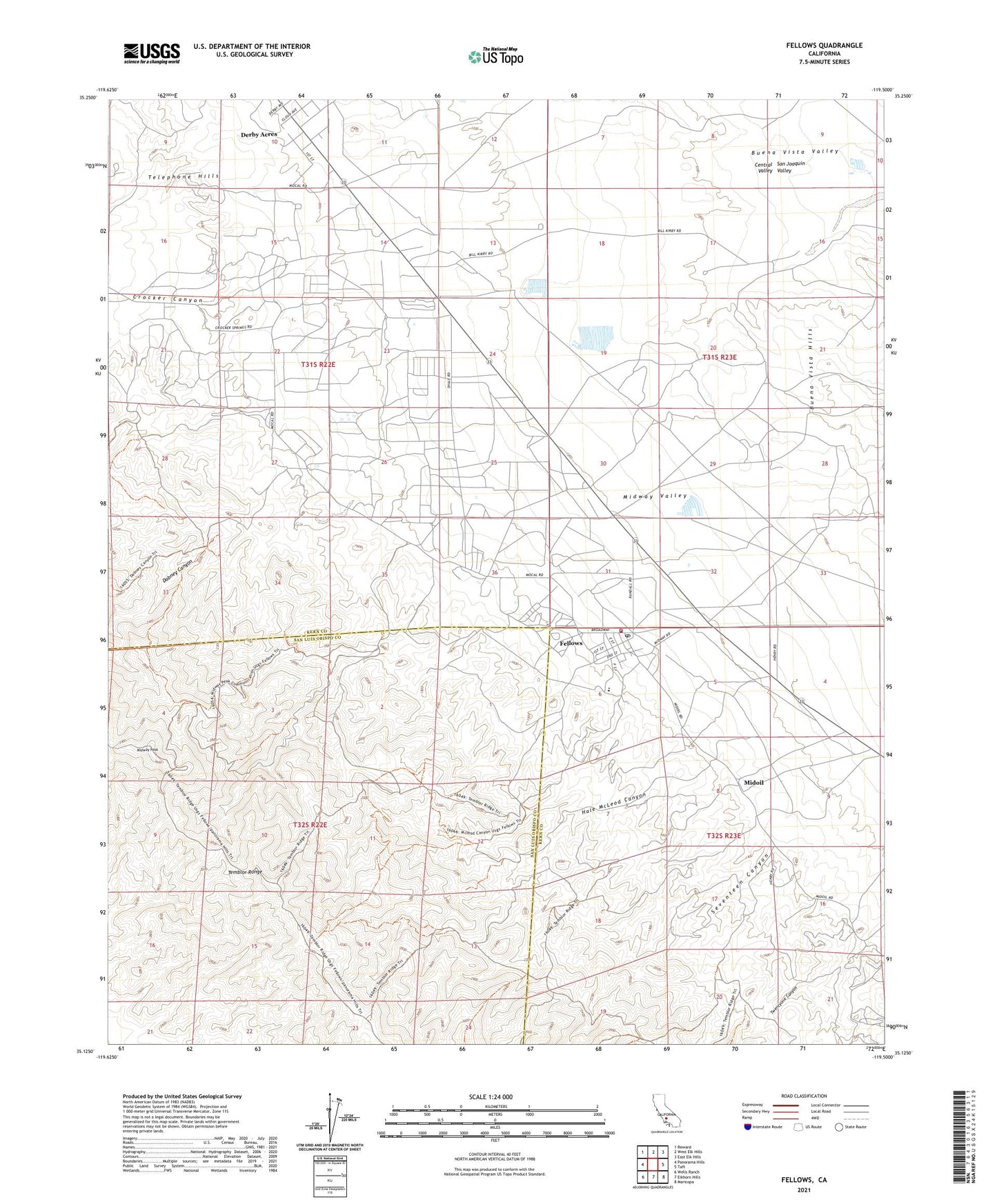
Fellows California US Topo Map
Couldn't load pickup availability
2021 topographic map quadrangle Fellows in the state of California. Scale: 1:24000. Based on the newly updated USGS 7.5' US Topo map series, this map is in the following counties: Kern, San Luis Obispo. The map contains contour data, water features, and other items you are used to seeing on USGS maps, but also has updated roads and other features. This is the next generation of topographic maps. Printed on high-quality waterproof paper with UV fade-resistant inks.
Quads adjacent to this one:
West: Panorama Hills
Northwest: Reward
North: West Elk Hills
Northeast: East Elk Hills
East: Taft
Southeast: Maricopa
South: Elkhorn Hills
Southwest: Wells Ranch
This map covers the same area as the classic USGS quad with code o35119b5.
Contains the following named places: Associated Oil Camp, Crocker Canyon, Dabney Canyon, Derby Acres, Derby Acres Census Designated Place, Fellows, Fellows Census Designated Place, Fellows Post Office, Hale McLeod Canyon, Kern County Fire Department Station 23 Fellows, Midoil, Midway Elementary School, Midway Oil Camp, Midway Peak, Midway Pumping Station, Seventeen Canyon, Twentyone Canyon, Warren, ZIP Code: 93224