
MyTopo
Fields Landing California US Topo Map
Couldn't load pickup availability
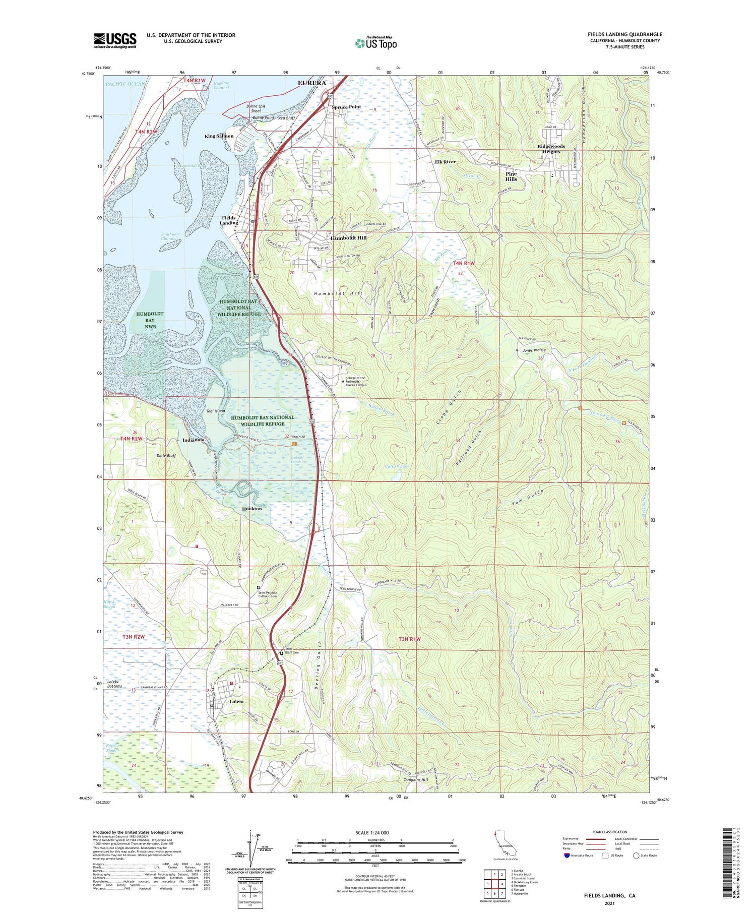
2021 topographic map quadrangle Fields Landing in the state of California. Scale: 1:24000. Based on the newly updated USGS 7.5' US Topo map series, this map is in the following counties: Humboldt. The map contains contour data, water features, and other items you are used to seeing on USGS maps, but also has updated roads and other features. This is the next generation of topographic maps. Printed on high-quality waterproof paper with UV fade-resistant inks.
Quads adjacent to this one:
West: Cannibal Island
North: Eureka
Northeast: Arcata South
East: McWhinney Creek
Southeast: Hydesville
South: Fortuna
Southwest: Ferndale
This map covers the same area as the classic USGS quad with code o40124f2.
Contains the following named places: Banner School, Beatrice, Bertas Ranch, Bertas Ranch Bridge, Bucksport School, Buhne Point, Buhne Spit Shoal, Catfish Lake, Clapp Gulch, College of the Redwoods - Eureka Campus, Deering Gulch, Elk River, Elk River School, Falk, Fields Landing, Fields Landing Census Designated Place, Fields Landing Post Office, Hookton, Hookton Channel, Hookton Slough, Hookton Slough Trail, Humboldt Bay, Humboldt Bay National Wildlife Refuge, Humboldt Hill, Humboldt Hill Census Designated Place, Indianola, Jones Prairie, Jones Prairie School, King Salmon, King Salmon Census Designated Place, King Salmon Slough, KKDV-AM (Fields Landing), KRED-AM (Eureka), KWHZ-FM (Ferndale), Little Salmon Creek, Loleta, Loleta Bottoms, Loleta Census Designated Place, Loleta Community Evangelical Free Church, Loleta Elementary School, Loleta Post Office, Loleta Volunteer Fire Department, Loleta Volunteer Fire Department Station 2 Storage, Long Pond, North Fork Elk River, Orton Creek, Pine Hills, Pine Hills Census Designated Place, Railroad Gulch, Red Bluff, Ridgewoods Heights, Rohnerville Rancheria, Saint Patricks Catholic Church, Salmon Creek, Salmon Creek School, Shaw Gulch, Shorebird Loop Trail, South Bay, South Bay Elementary School, South Fork Elk River, South Spit, Southport Channel, Southport Landing, Spruce Point, Table Bluff, Table Bluff Cemetery, Table Bluff Rancheria, Teal Island, Tom Gulch, Tompkins Hill, Triangle Marsh, Willow Brook, Zanes Ranch, Zanes Ranch Bridge, ZIP Codes: 95537, 95551


