MyTopo
Fortuna California US Topo Map
Couldn't load pickup availability
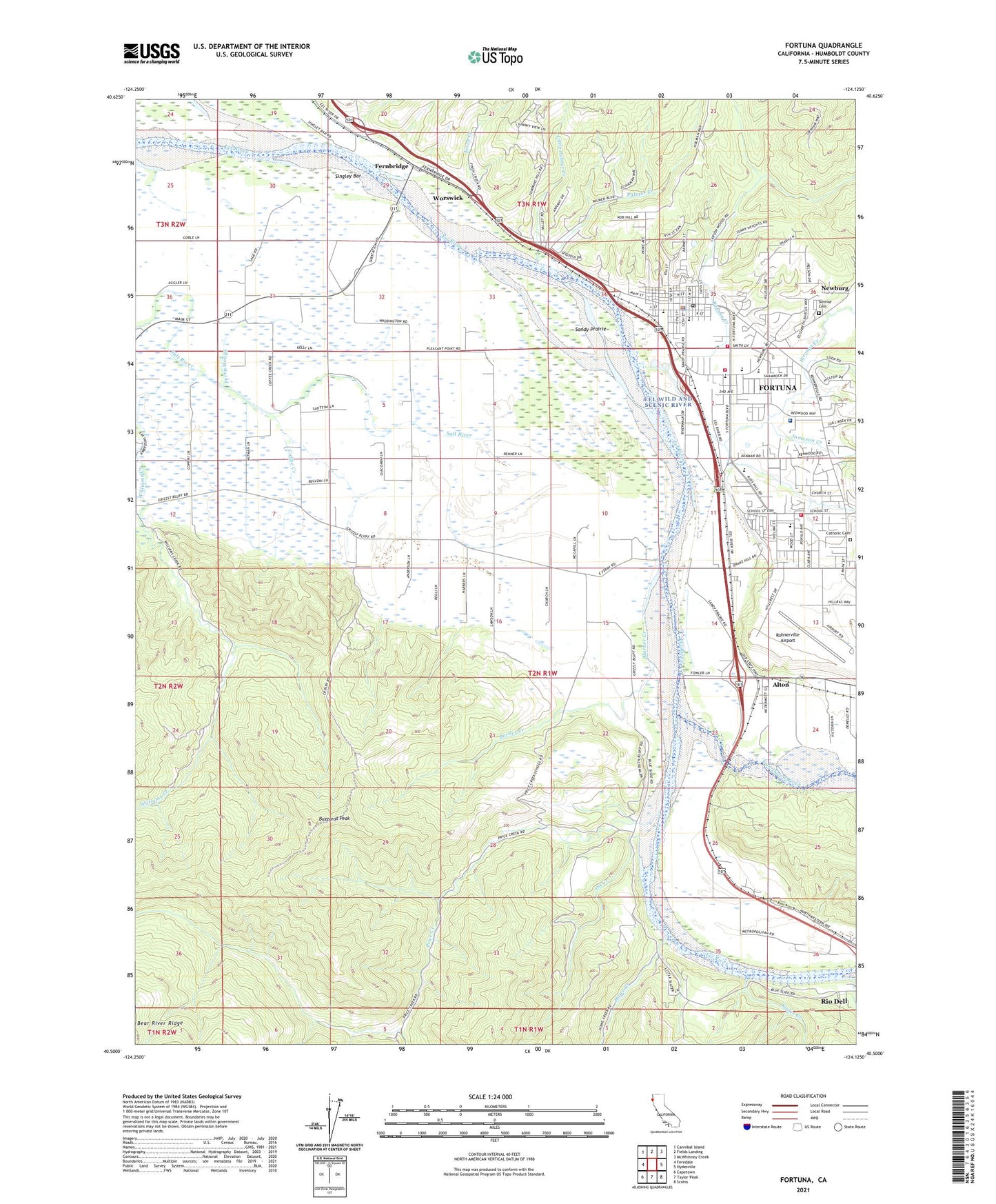
2021 topographic map quadrangle Fortuna in the state of California. Scale: 1:24000. Based on the newly updated USGS 7.5' US Topo map series, this map is in the following counties: Humboldt. The map contains contour data, water features, and other items you are used to seeing on USGS maps, but also has updated roads and other features. This is the next generation of topographic maps. Printed on high-quality waterproof paper with UV fade-resistant inks.
Quads adjacent to this one:
West: Ferndale
Northwest: Cannibal Island
North: Fields Landing
Northeast: McWhinney Creek
East: Hydesville
Southeast: Scotia
South: Taylor Peak
Southwest: Capetown
This map covers the same area as the classic USGS quad with code o40124e2.
Contains the following named places: Alton, Alton Census Designated Place, Barber Creek, Buzzards Peak, California Department of Forestry and Fire Protection Fortuna Fire Department Headquarters, California Department of Forestry and Fire Protection Humboldt Del Norte Unit, Calvary Christian Church, Catholic Cemetery, Christ Lutheran Church, City of Fortuna, City of Fortuna Wastewater Treatment Plant, Coffee Creek, Coffee Creek School, Fernbridge, Finch Creek, First Baptist Church of Fortuna, Fortuna, Fortuna Branch Humboldt County Library, Fortuna Elementary School, Fortuna Junior Academy, Fortuna Missionary Baptist Church, Fortuna Nursery School, Fortuna Police Department, Fortuna Post Office, Fortuna Seventh Day Adventist Church, Fortuna Union High School, Fortuna United Methodist Church, Fortuna Volunteer Fire Department, Fortuna Volunteer Fire Department Campton Heights Station, Grace Chapel, Grant School, Grant Union School, Grizzly Bluff, Grizzly Bluff School, Hansen Pit, Howe Creek, Jameson Creek, Little Palmer Creek, Metropolitan, New Life Christian School / Great Beginnings Preschool, Newburg Park, Norman G Ambrosini Elementary School, Oil Creek, Palmer Creek, Perry Slough, Pleasant Point School, Price Creek, Price Creek School, Redwood Memorial Hospital, Redwood Village Shopping Center, Rohner Creek, Rohner Park, Rohnerville, Rohnerville Airport, Rohnerville Assembly of God Church, Saint Francis Episcopal Church, Saint Josephs Roman Catholic Church, Saint Pius X Seminary, Sandy Prairie, Singley Bar, Slater Creek, South Fortuna Elementary School, Strongs Creek, Sunrise Cemetery, Sweet Creek, Toddy Thomas Elementary School, Van Duzen River, Waddington, Weymouth Inn, Williams Creek, Williams Creek School, Wood Street Chapel, Worswick, ZIP Code: 95540