MyTopo
Fry Mountains California US Topo Map
Couldn't load pickup availability
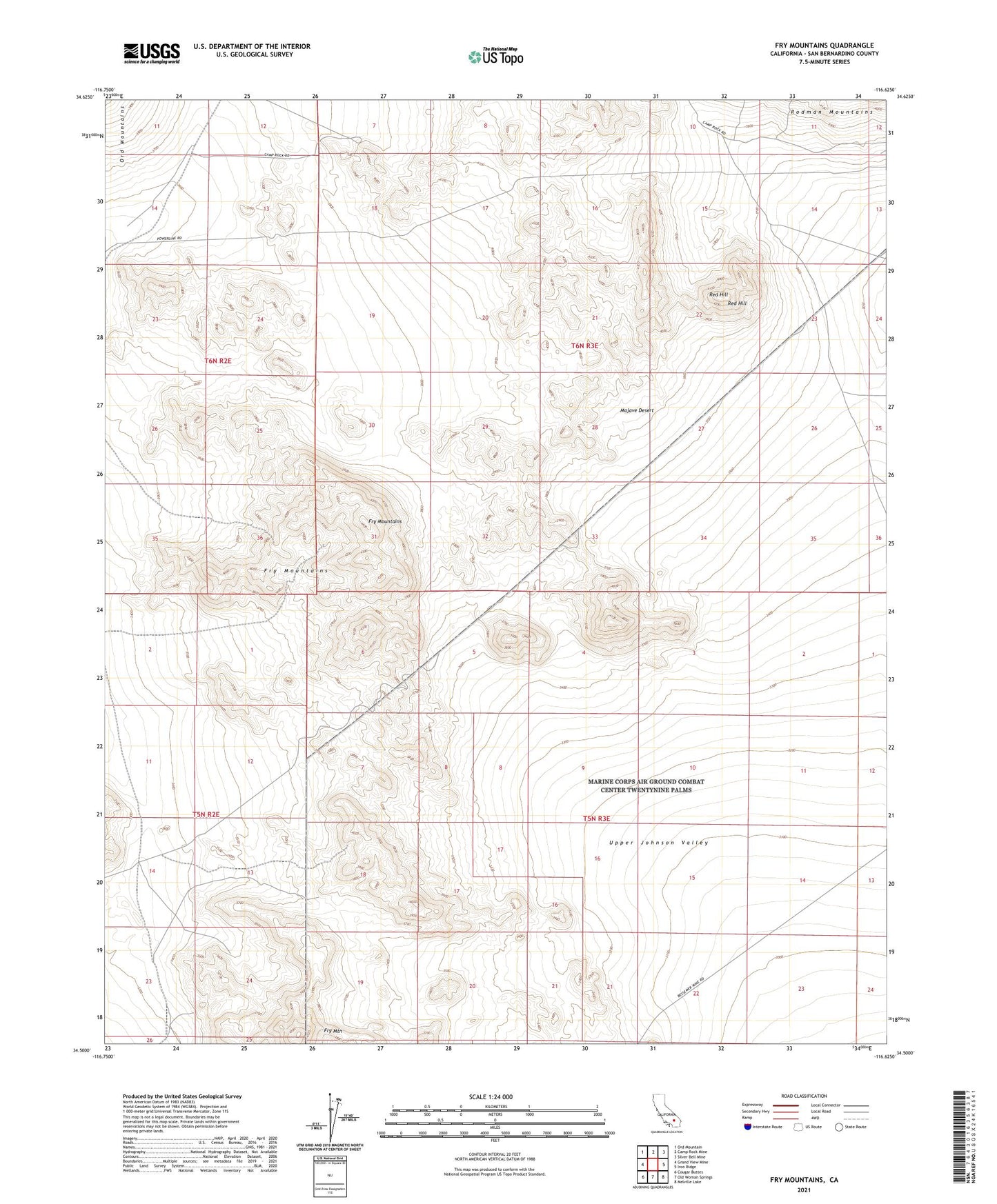
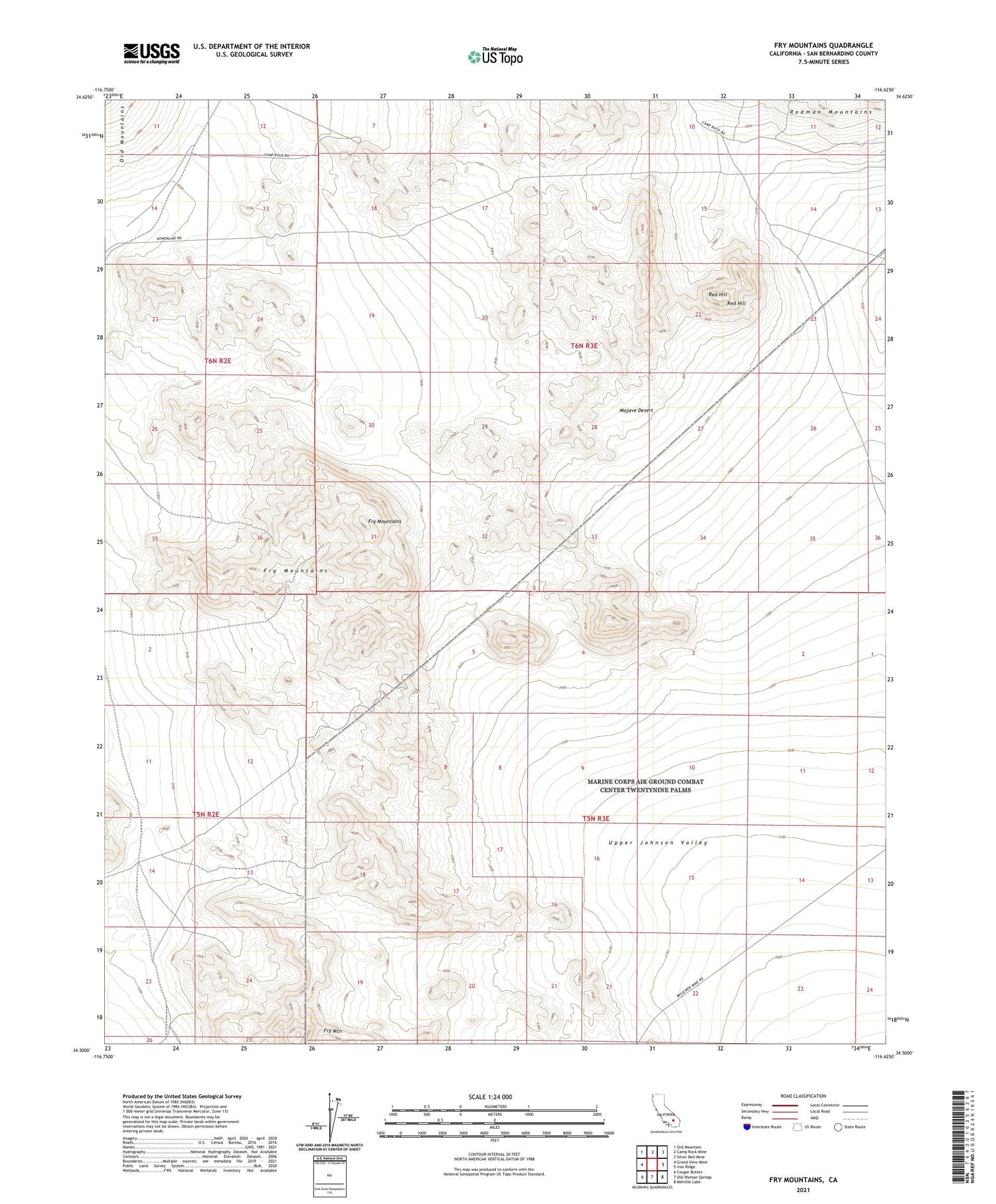
2021 topographic map quadrangle Fry Mountains in the state of California. Scale: 1:24000. Based on the newly updated USGS 7.5' US Topo map series, this map is in the following counties: San Bernardino. The map contains contour data, water features, and other items you are used to seeing on USGS maps, but also has updated roads and other features. This is the next generation of topographic maps. Printed on high-quality waterproof paper with UV fade-resistant inks.
Quads adjacent to this one:
West: Grand View Mine
Northwest: Ord Mountain
North: Camp Rock Mine
Northeast: Silver Bell Mine
East: Iron Ridge
Southeast: Melville Lake
South: Old Woman Springs
Southwest: Cougar Buttes
Contains the following named places: Fry Mountain, Fry Mountains, Red Hill