MyTopo
Melville Lake California US Topo Map
Couldn't load pickup availability
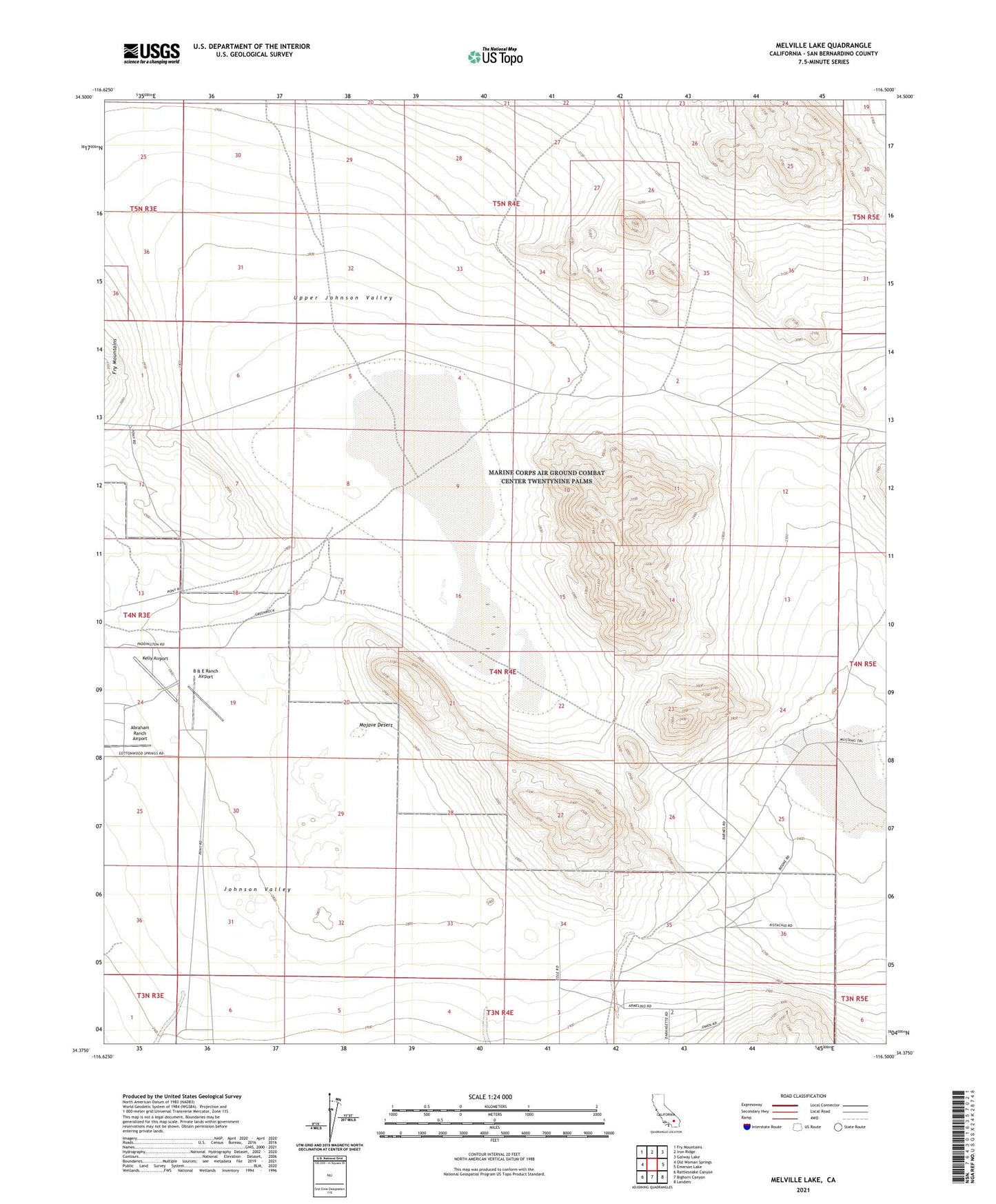
2021 topographic map quadrangle Melville Lake in the state of California. Scale: 1:24000. Based on the newly updated USGS 7.5' US Topo map series, this map is in the following counties: San Bernardino. The map contains contour data, water features, and other items you are used to seeing on USGS maps, but also has updated roads and other features. This is the next generation of topographic maps. Printed on high-quality waterproof paper with UV fade-resistant inks.
Quads adjacent to this one:
West: Old Woman Springs
Northwest: Fry Mountains
North: Iron Ridge
Northeast: Galway Lake
East: Emerson Lake
Southeast: Landers
South: Bighorn Canyon
Southwest: Rattlesnake Canyon
This map covers the same area as the classic USGS quad with code o34116d5.
Contains the following named places: Abraham Ranch Airport, B & E Ranch Airport, Johnson Valley, Kelly Airport, Means Lake, Means Well, Melville Lake, Shehorn Ranch, Upper Johnson Valley