MyTopo
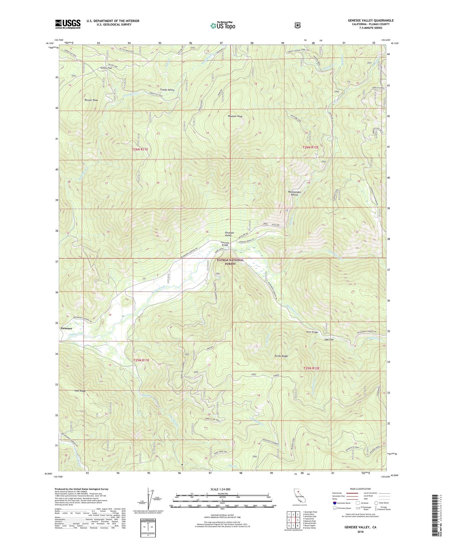
Genesee Valley California US Topo Map
Couldn't load pickup availability
Also explore the Genesee Valley Forest Service Topo of this same quad for updated USFS data
2022 topographic map quadrangle Genesee Valley in the state of California. Scale: 1:24000. Based on the newly updated USGS 7.5' US Topo map series, this map is in the following counties: Plumas. The map contains contour data, water features, and other items you are used to seeing on USGS maps, but also has updated roads and other features. This is the next generation of topographic maps. Printed on high-quality waterproof paper with UV fade-resistant inks.
Quads adjacent to this one:
West: Taylorsville
Northwest: Moonlight Peak
North: Kettle Rock
Northeast: Antelope Lake
East: Babcock Peak
Southeast: Grizzly Valley
South: Mount Ingalls
Southwest: Spring Garden
This map covers the same area as the classic USGS quad with code o40120a6.
Contains the following named places: Beardsley Mine, Clearwater Creek, Davis Creek, Davis Family Cemetery, Drum Bridge, Elephants Playground, Flournoy Bridge, Franks Valley, Green Flat, Hungry Creek, Kessler Peak, Last Chance Creek, Middle Creek, North Branch Ward Creek, Nye Creek, Oak Flat, Peel Ridge, Rattlesnake Ravine, Red Clover Creek, Rock Creek, South Branch Ward Creek, Ward Creek, Wheeler Peak, ZIP Code: 95983