MyTopo
Antelope Lake California US Topo Map
Couldn't load pickup availability
Also explore the Antelope Lake Forest Service Topo of this same quad for updated USFS data
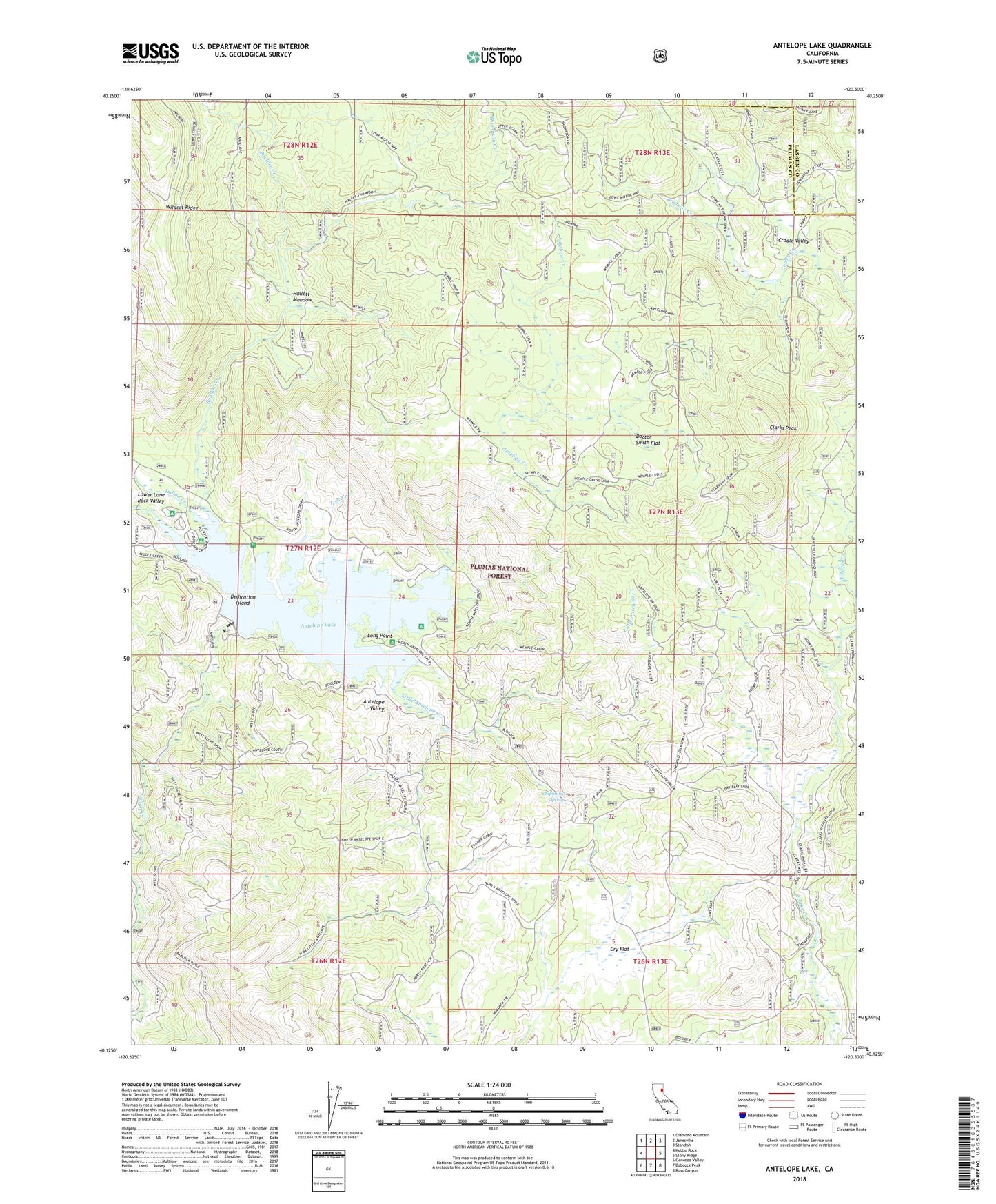
2022 topographic map quadrangle Antelope Lake in the state of California. Scale: 1:24000. Based on the newly updated USGS 7.5' US Topo map series, this map is in the following counties: Plumas, Lassen. The map contains contour data, water features, and other items you are used to seeing on USGS maps, but also has updated roads and other features. This is the next generation of topographic maps. Printed on high-quality waterproof paper with UV fade-resistant inks.
Quads adjacent to this one:
West: Kettle Rock
Northwest: Diamond Mountain
North: Janesville
Northeast: Standish
East: Stony Ridge
Southeast: Ross Canyon
South: Babcock Peak
Southwest: Genesee Valley
This map covers the same area as the classic USGS quad with code o40120b5.
Contains the following named places: Antelope 1-050 Dam, Antelope Creek, Antelope Lake, Antelope Valley, Antelope Valley Dam, Bootsole Creek, Boulder Creek, Boulder Creek Campground, Boulder Creek Work Center, Chipmunk Spring, Clarks Peak, Cold Stream, Cradle Valley, Dedication Island, Doctor Smith Flat, Dry Flat, Frazier Cabin, Hallett Meadow, Harwood Cabin, Little Antelope Creek, Lone Rock Campground, Lone Rock Creek, Long Point, Long Point Campground, Lost Cove Picnic Area, Lost Creek, Pioneer Cabin, Thompson Creek, Wemple Cabin