MyTopo
Gilsizer Slough California US Topo Map
Couldn't load pickup availability
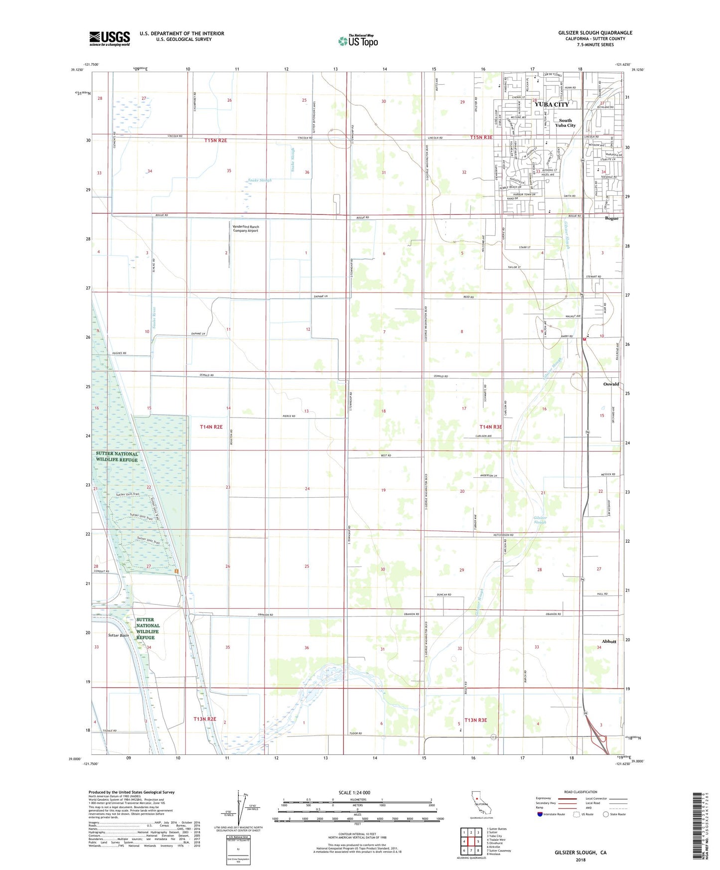
2022 topographic map quadrangle Gilsizer Slough in the state of California. Scale: 1:24000. Based on the newly updated USGS 7.5' US Topo map series, this map is in the following counties: Sutter. The map contains contour data, water features, and other items you are used to seeing on USGS maps, but also has updated roads and other features. This is the next generation of topographic maps. Printed on high-quality waterproof paper with UV fade-resistant inks.
Quads adjacent to this one:
West: Tisdale Weir
Northwest: Sutter Buttes
North: Sutter
Northeast: Yuba City
East: Olivehurst
Southeast: Nicolaus
South: Sutter Causeway
Southwest: Kirkville
This map covers the same area as the classic USGS quad with code o39121a6.
Contains the following named places: Abbott, Barry Elementary School, Barry Substation, Central Gaither Elementary School, Gilsizer Slough, Grace Church, Grant School, Holy Angel School, KUBA-AM (Yuba City), KXCL-FM (Yuba City), Lincoln Elementary School, Lincrest Elementary School, Little Blue Creek, O'Bannon School, Oswald, Saint Isidore Catholic Church, Snake River, Snake Slough, South Yuba City, South Yuba City Census Designated Place, Sutter By-Pass, Sutter County, Sutter County Fire Department, Sutter National Wildlife Refuge, Vanderford Ranch Company Airport, Yuba City Southwest Division, ZIP Code: 95993