MyTopo
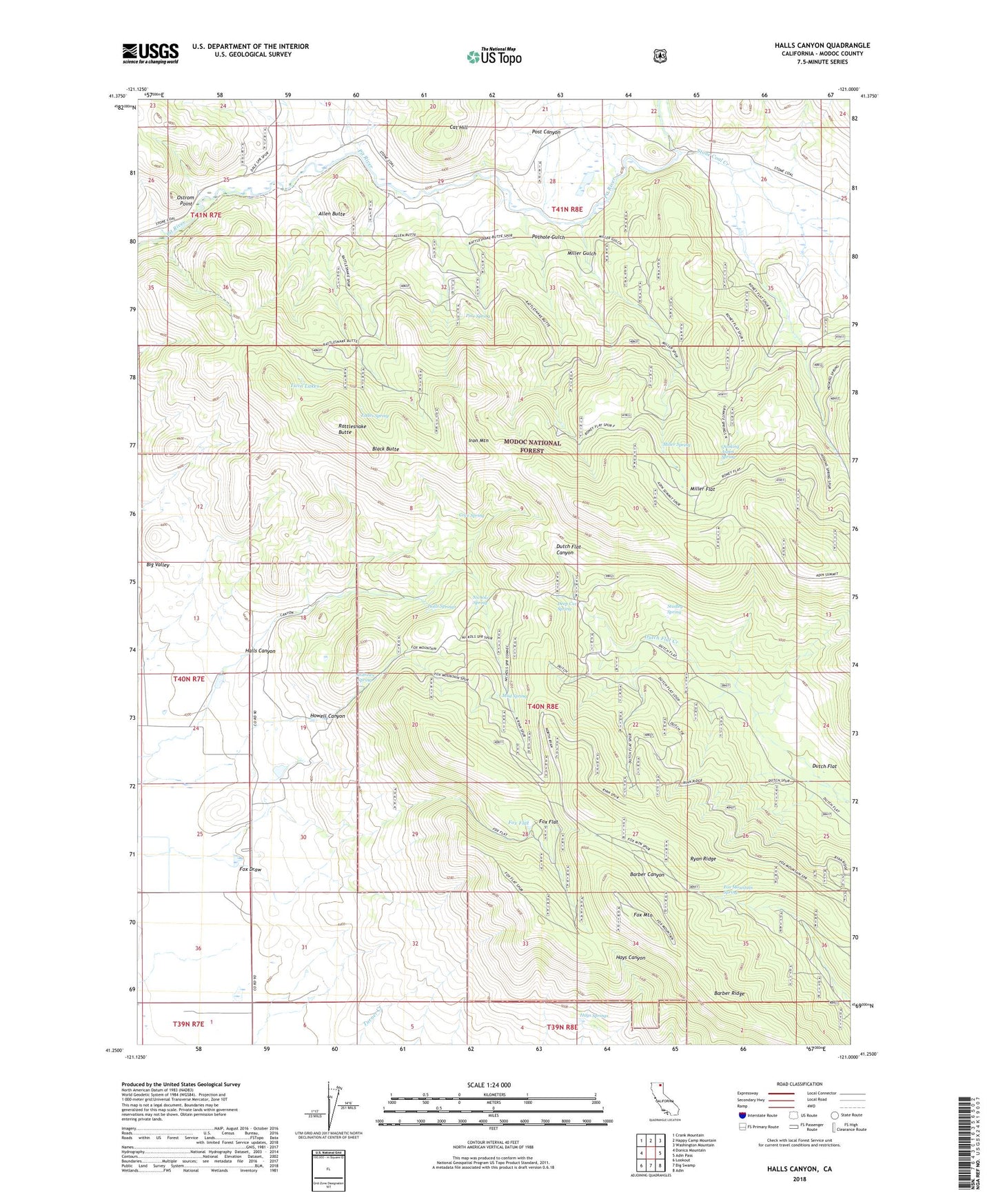
Halls Canyon California US Topo Map
Couldn't load pickup availability
Also explore the Halls Canyon Forest Service Topo of this same quad for updated USFS data
2021 topographic map quadrangle Halls Canyon in the state of California. Scale: 1:24000. Based on the newly updated USGS 7.5' US Topo map series, this map is in the following counties: Modoc. The map contains contour data, water features, and other items you are used to seeing on USGS maps, but also has updated roads and other features. This is the next generation of topographic maps. Printed on high-quality waterproof paper with UV fade-resistant inks.
Quads adjacent to this one:
West: Donica Mountain
Northwest: Crank Mountain
North: Happy Camp Mountain
Northeast: Washington Mountain
East: Adin Pass
Southeast: Adin
South: Big Swamp
Southwest: Lookout
This map covers the same area as the classic USGS quad with code o41121c1.
Contains the following named places: Allen Butte, Allen Camp, Andrews Spring, Barber Ridge, Black Butte, Cat Hill, Cove Spring, Deep Cut Spring, Dutch Flat, Eades Spring, Fox Draw, Fox Flat, Fox Mountain, Fox Mountain Spring, Halls Canyon, Halls Springs, Hays Springs, Howell Canyon, Iron Mountain, Miller Flat, Miller Gulch, Miller Spring, Mud Spring, Nichols Spring, Ostrom Point, Pine Spring, Post Canyon, Pothole Gulch, Quaking Aspen Spring, Rattlesnake Butte, Ryan Ridge, Stone Coal Creek, Stone Coal Valley, Studley Spring, Twin Lakes