MyTopo
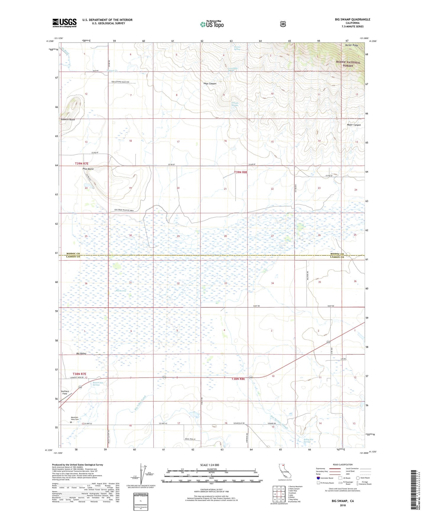
Big Swamp California US Topo Map
Couldn't load pickup availability
Also explore the Big Swamp Forest Service Topo of this same quad for updated USFS data
2022 topographic map quadrangle Big Swamp in the state of California. Scale: 1:24000. Based on the newly updated USGS 7.5' US Topo map series, this map is in the following counties: Modoc, Lassen. The map contains contour data, water features, and other items you are used to seeing on USGS maps, but also has updated roads and other features. This is the next generation of topographic maps. Printed on high-quality waterproof paper with UV fade-resistant inks.
Quads adjacent to this one:
West: Lookout
Northwest: Donica Mountain
North: Halls Canyon
Northeast: Adin Pass
East: Adin
Southeast: Letterbox Hill
South: Hog Valley
Southwest: Bieber
This map covers the same area as the classic USGS quad with code o41121b1.
Contains the following named places: Albaugh Number 1 1242 Dam, Ash Creek State Wildlife Area, Ash Creek Wildlife Area, Bassett Hot Springs, Big Swamp, Big Valley Canal, Butte School, Hays Canyon, Hot Springs, Hot Springs Slough, Kellog Hot Springs, Leonard, Long Billy Spring, Lookout Rancheria, Major Canyon, Meeks Place, Mountain View Cemetery, O'Neals Springs, Pilot Butte, Pundy Ranch, Roberts Butte, Service Spring, Southard Field, Turner Canyon, Turner Ranch, ZIP Code: 96054