
MyTopo
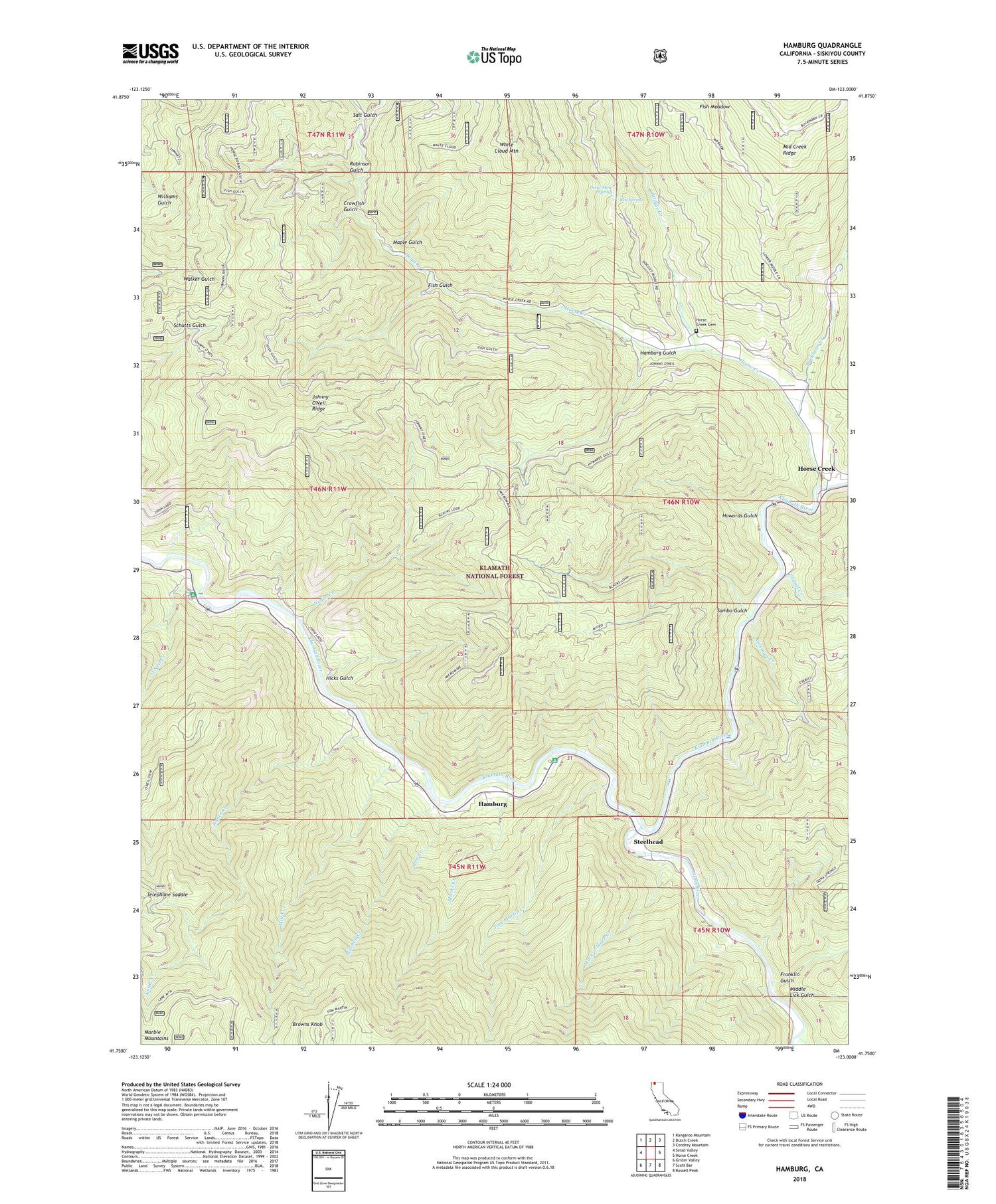
Hamburg California US Topo Map
Couldn't load pickup availability
Also explore the Hamburg Forest Service Topo of this same quad for updated USFS data
2022 topographic map quadrangle Hamburg in the state of California. Scale: 1:24000. Based on the newly updated USGS 7.5' US Topo map series, this map is in the following counties: Siskiyou. The map contains contour data, water features, and other items you are used to seeing on USGS maps, but also has updated roads and other features. This is the next generation of topographic maps. Printed on high-quality waterproof paper with UV fade-resistant inks.
Quads adjacent to this one:
West: Seiad Valley
Northwest: Kangaroo Mountain
North: Dutch Creek
Northeast: Condrey Mountain
East: Horse Creek
Southeast: Russell Peak
South: Scott Bar
Southwest: Grider Valley
This map covers the same area as the classic USGS quad with code o41123g1.
Contains the following named places: Blue Heron River Access, Browns Knob, Buckhorn Creek, China Doctor Creek, Crawfish Gulch, Dead Mole Spring, Everill Creek, Fish Gulch, Fish Meadow, Franklin Gulch, Hamburg, Hamburg Cemetery, Hamburg Gulch, Hicks Gulch, Horse Creek, Horse Creek Cemetery, Horse Creek School, Howards Gulch, Jim Creek, Johnny O'Neil Ridge, Kinsman Creek, Kuntz Creek, Ladd Mine, Macks Creek, Maple Gulch, Middle Creek, Middle Lick Gulch, Mill Creek, Mitchell Creek, Muck-a-Muck Creek, Negro Creek, O'Neil Creek, O'Neil Creek Campground, Red Spring, Robinson Gulch, Salt Gulch, Sambo Gulch, Sarah Totten Campground, Scott River, Steelhead, Telephone Saddle, Tom Martin Creek, White Cloud Mountain


