MyTopo
Russell Peak California US Topo Map
Couldn't load pickup availability
Also explore the Russell Peak Forest Service Topo of this same quad for updated USFS data
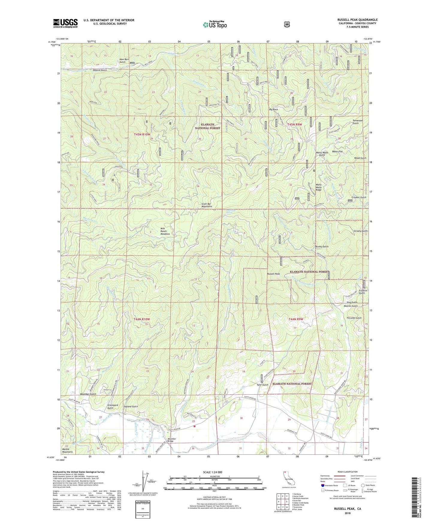
2022 topographic map quadrangle Russell Peak in the state of California. Scale: 1:24000. Based on the newly updated USGS 7.5' US Topo map series, this map is in the following counties: Siskiyou. The map contains contour data, water features, and other items you are used to seeing on USGS maps, but also has updated roads and other features. This is the next generation of topographic maps. Printed on high-quality waterproof paper with UV fade-resistant inks.
Quads adjacent to this one:
West: Scott Bar
Northwest: Hamburg
North: Horse Creek
Northeast: McKinley Mountain
East: Indian Creek Baldy
Southeast: Fort Jones
South: Greenview
Southwest: Boulder Peak
This map covers the same area as the classic USGS quad with code o41122f8.
Contains the following named places: Baker Cabin, Baker Flat, Big Rock, Brushy Gulch, Chipmunk Spring, Crooker Gulch, East Fork Rattlesnake Creek, Fort Jones Division, Franklin Gulch, Franklin Mine, Graveyard Gulch, Gumboot Mine, Hossick Gulch, Hunters Gulch, Joyland Gulch, Lone Star School, Marilyn Creek, Meamber Bridge, Meamber Creek, Meamber Gulch, Meamber School, Milk Ranch Meadows, Moores Gulch, New Barn Gulch, Patterson Creek, Quartz Valley, Russell Peak, Scott Valley, Scott Valley Fire Protection District Scott River, Shackleford Creek, Sheba Mine, Shelba Mine, Singleton Creek, Slug Creek, Slug Gulch, Sniktaw Creek, South Fork Mill Creek, Titcomb Gulch, Tyler Gulch, Walla Walla Ridge, West Fork Rattlesnake Creek