MyTopo
Highland Springs California US Topo Map
Couldn't load pickup availability
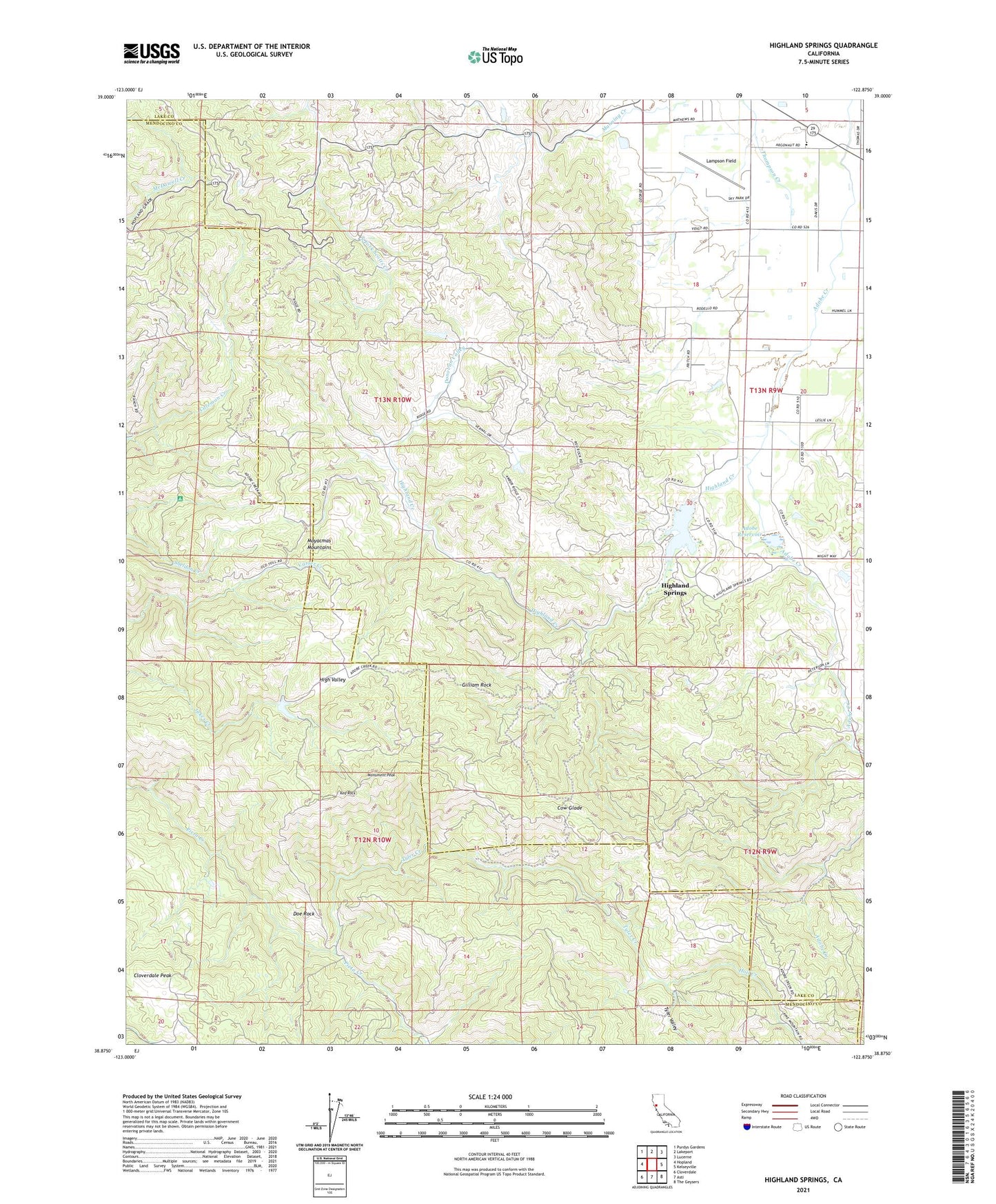
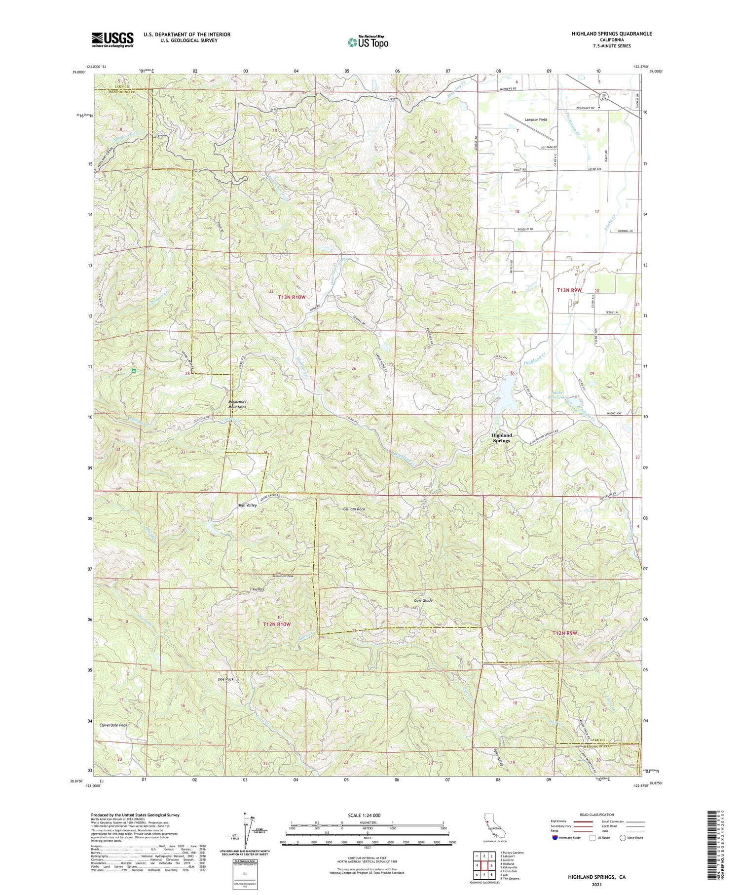
2021 topographic map quadrangle Highland Springs in the state of California. Scale: 1:24000. Based on the newly updated USGS 7.5' US Topo map series, this map is in the following counties: Lake, Mendocino. The map contains contour data, water features, and other items you are used to seeing on USGS maps, but also has updated roads and other features. This is the next generation of topographic maps. Printed on high-quality waterproof paper with UV fade-resistant inks.
Quads adjacent to this one:
West: Hopland
Northwest: Purdys Gardens
North: Lakeport
Northeast: Lucerne
East: Kelseyville
Southeast: The Geysers
South: Asti
Southwest: Cloverdale
This map covers the same area as the classic USGS quad with code o38122h8.
Contains the following named places: Adobe Creek 1011 Dam, Adobe Reservoir, Big Valley Community Center, Blood Ranch, Chateau Du Lac, Cloverdale Peak, Cow Glade, Davis Ranch, Doe Rock, Donovan Valley, Gilliam Rock, Graham 395 Dam, High Valley, High Valley Ranch, Highland Creek, Highland Creek 1011-002 Dam, Highland Springs, Highland Springs Reservoir, Hoil Creek, Kelseyville Division, Lampson Field, Manning Creek, McGoldrick Ranch, Monument Peak, Red Rock, Sheldon Ranch, Snyder Ranch, Tyler Creek, Tyler Valley