
MyTopo
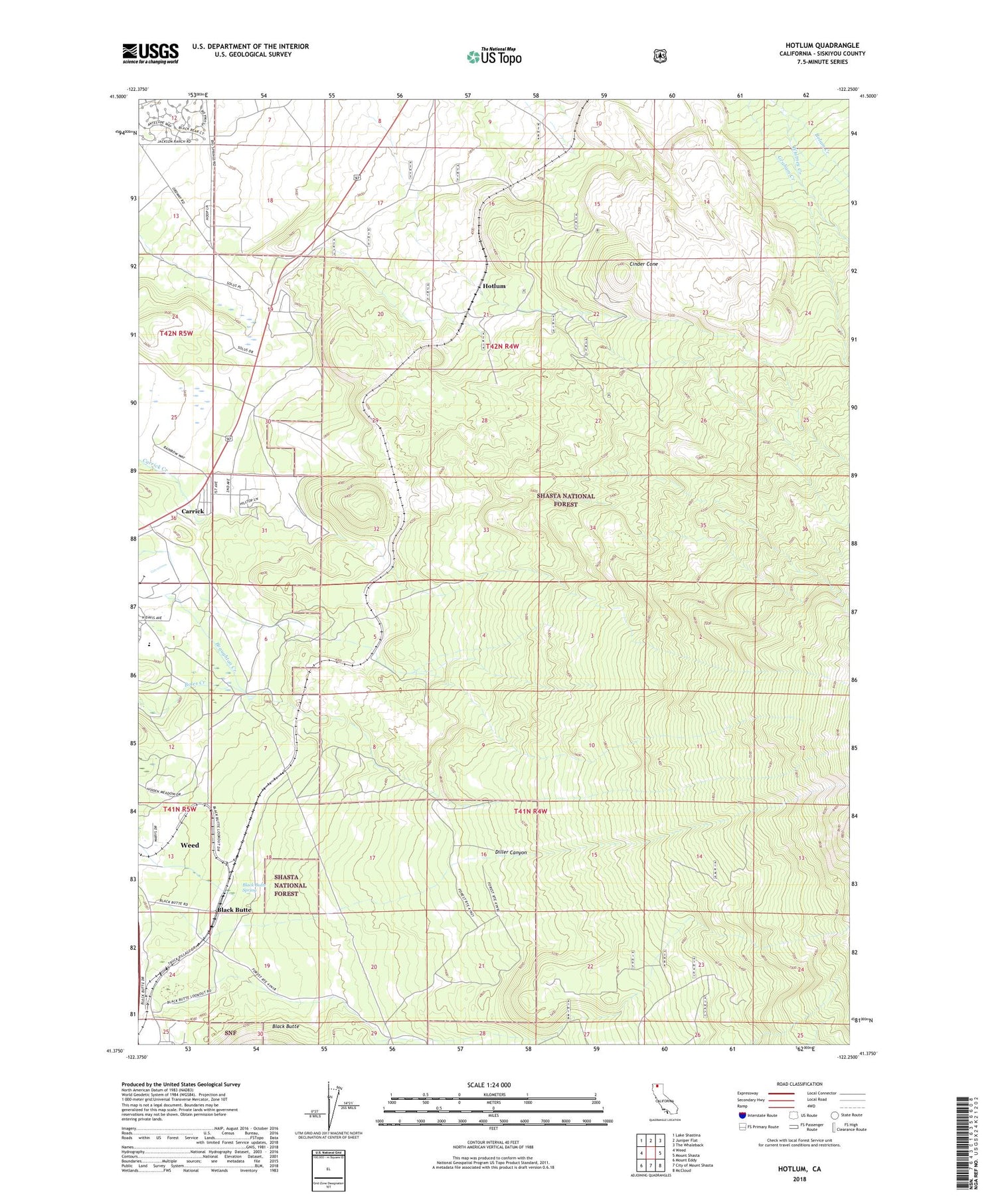
Hotlum California US Topo Map
Couldn't load pickup availability
Also explore the Hotlum Forest Service Topo of this same quad for updated USFS data
2022 topographic map quadrangle Hotlum in the state of California. Scale: 1:24000. Based on the newly updated USGS 7.5' US Topo map series, this map is in the following counties: Siskiyou. The map contains contour data, water features, and other items you are used to seeing on USGS maps, but also has updated roads and other features. This is the next generation of topographic maps. Printed on high-quality waterproof paper with UV fade-resistant inks.
Quads adjacent to this one:
West: Weed
Northwest: Lake Shastina
North: Juniper Flat
Northeast: The Whaleback
East: Mount Shasta
Southeast: McCloud
South: City of Mount Shasta
Southwest: Mount Eddy
This map covers the same area as the classic USGS quad with code o41122d3.
Contains the following named places: Black Butte, Black Butte Spring, Bolam Creek, Carrick, Carrick Census Designated Place, Cinder Cone, Diller Canyon, Hotlum, Log Pond, Summit Lake, Weed High School


