MyTopo
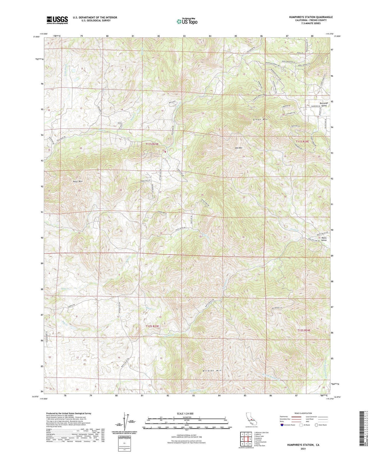
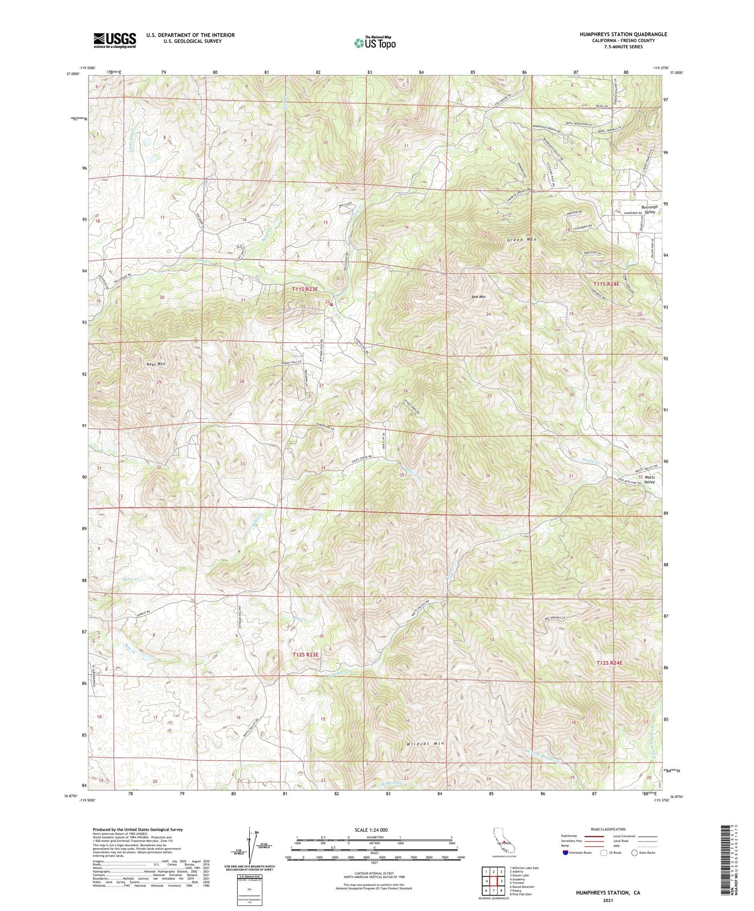
Humphreys Station California US Topo Map
Couldn't load pickup availability
2021 topographic map quadrangle Humphreys Station in the state of California. Scale: 1:24000. Based on the newly updated USGS 7.5' US Topo map series, this map is in the following counties: Fresno. The map contains contour data, water features, and other items you are used to seeing on USGS maps, but also has updated roads and other features. This is the next generation of topographic maps. Printed on high-quality waterproof paper with UV fade-resistant inks.
Quads adjacent to this one:
West: Academy
Northwest: Millerton Lake East
North: Auberry
Northeast: Shaver Lake
East: Trimmer
Southeast: Pine Flat Dam
South: Piedra
Southwest: Round Mountain
This map covers the same area as the classic USGS quad with code o36119h4.
Contains the following named places: Blasingame Fire Control Station, CAL FIRE / Fresno County Fire Protection District Blasingame Station, Clara H Mine, Copper King Mine, Green Mountain, Hawkins School, Humphreys Station, Jack Thorn Mine, Keys Mountain, KJFX-FM (Fresno), Mechanicsville School, Red Mountain, Sand Creek, Sentinel, Wildcat Mountain