MyTopo
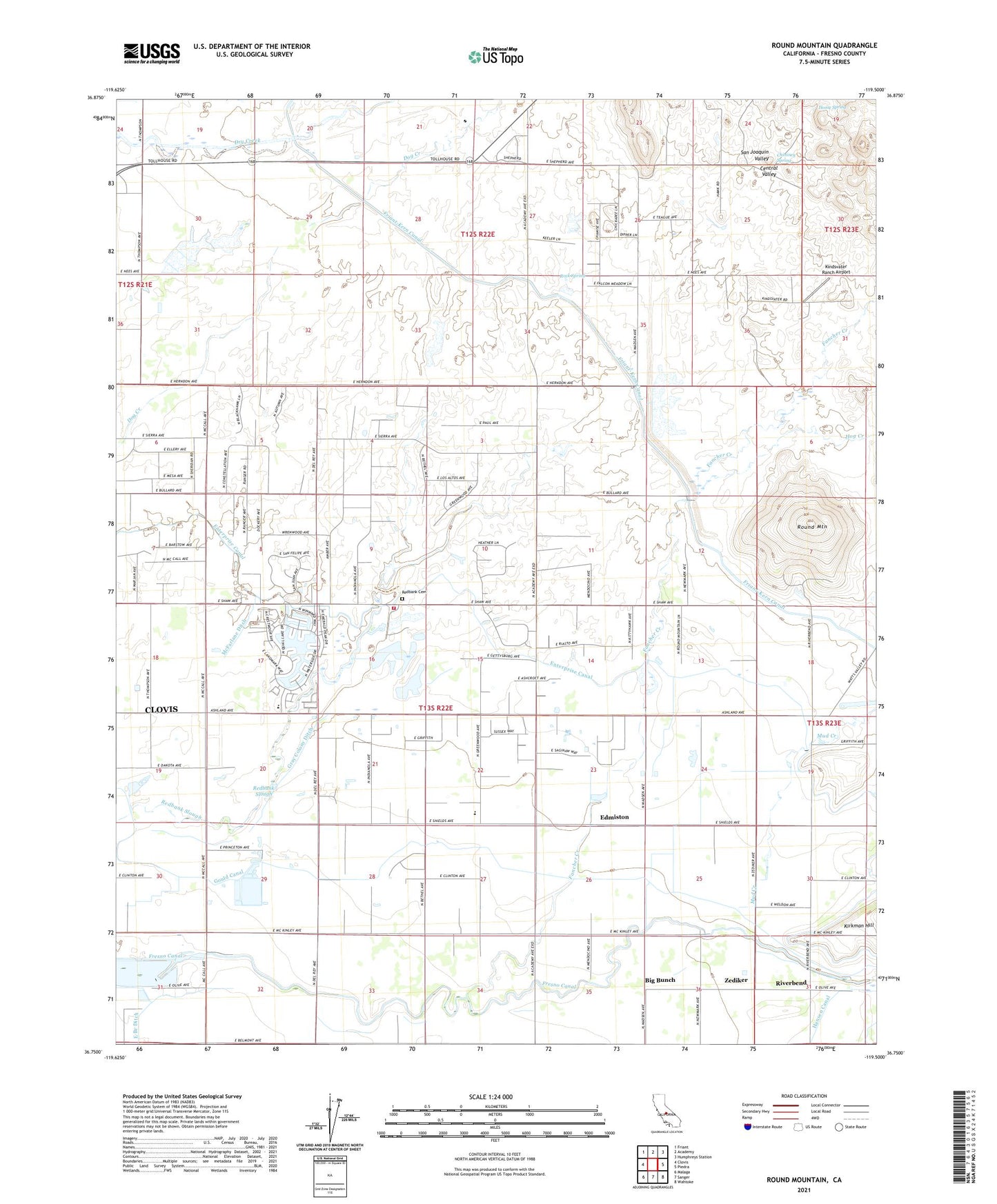
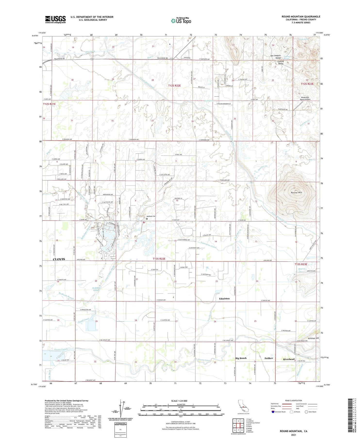
Round Mountain California US Topo Map
Couldn't load pickup availability
2021 topographic map quadrangle Round Mountain in the state of California. Scale: 1:24000. Based on the newly updated USGS 7.5' US Topo map series, this map is in the following counties: Fresno. The map contains contour data, water features, and other items you are used to seeing on USGS maps, but also has updated roads and other features. This is the next generation of topographic maps. Printed on high-quality waterproof paper with UV fade-resistant inks.
Quads adjacent to this one:
West: Clovis
Northwest: Friant
North: Academy
Northeast: Humphreys Station
East: Piedra
Southeast: Wahtoke
South: Sanger
Southwest: Malaga
Contains the following named places: Baird Ranch, Baker Farm, Big Bunch, Blasinger Ranch, Blue Jay Ranch, Chimney Spring, Collins, Daddino's Egg Ranch, East Branch Ditch, Edmiston, Fairmont Elementary School, Fairview Ditch, Fairview School, Fancher Creek, Fancher Ranch, Fresno Canal, Fresno County Fire Protection District Clovis Lakes Station 86, Gould Canal, Gray Colony Ditch, Gray Colony School, Hansen Ditch, Hog Creek, Home Spring, Kindsvater Ranch Airport, KTHT-FM (Fresno), Lindsay School, McFarlane Ditch, McLaglen Ranch, Mud Creek, Redbank 1017 Dam, Redbank Cemetery, Redbank Ranch, Redbank School, Redbank Slough, Riverbend, Rock Spring, Round Mountain, Round Mountain School, Sanger Division, Sunland Ranch, Zediker