MyTopo
Iris California US Topo Map
Couldn't load pickup availability
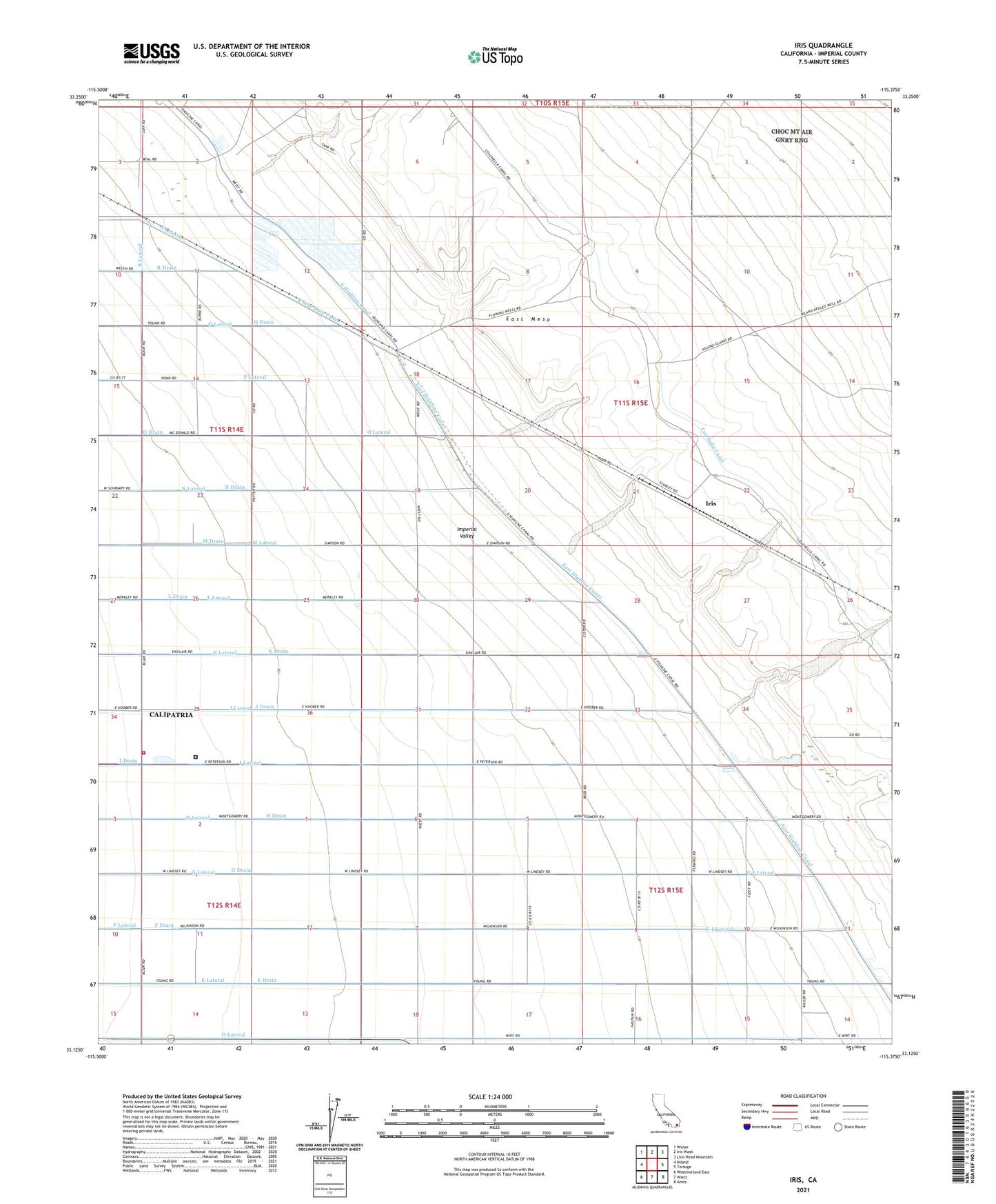
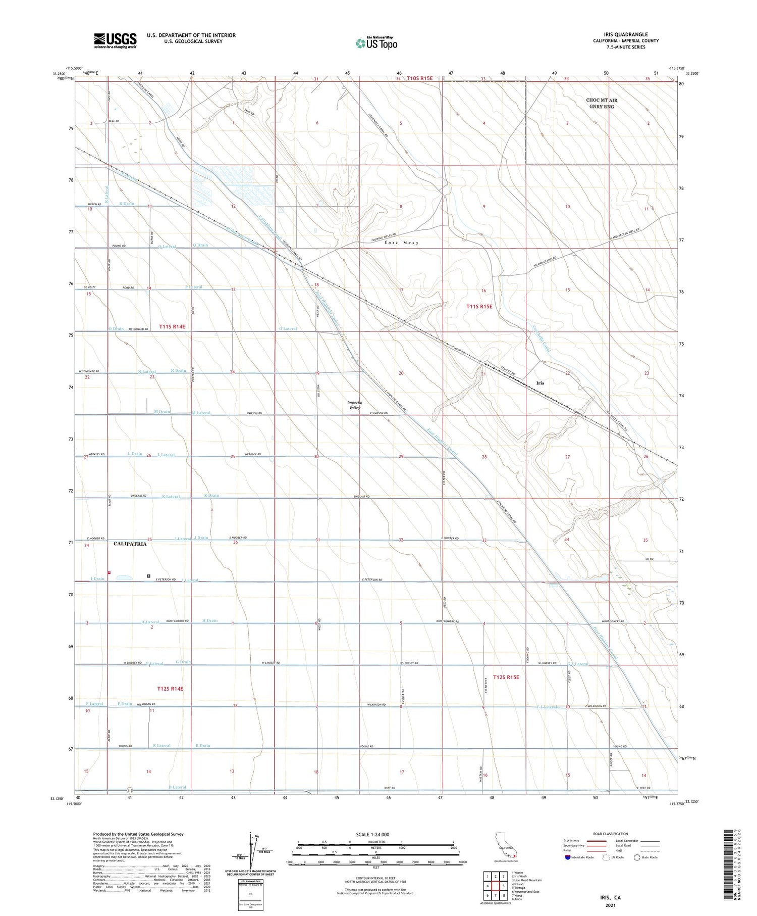
2021 topographic map quadrangle Iris in the state of California. Scale: 1:24000. Based on the newly updated USGS 7.5' US Topo map series, this map is in the following counties: Imperial. The map contains contour data, water features, and other items you are used to seeing on USGS maps, but also has updated roads and other features. This is the next generation of topographic maps. Printed on high-quality waterproof paper with UV fade-resistant inks.
Quads adjacent to this one:
West: Niland
Northwest: Wister
North: Iris Wash
Northeast: Lion Head Mountain
East: Tortuga
Southeast: Amos
South: Wiest
Southwest: Westmorland East
This map covers the same area as the classic USGS quad with code o33115b4.
Contains the following named places: Calipatria State Prison, Calipatria State Prison Fire Department, City of Calipatria, D Drain, D Lateral, E Drain, E Lateral, East Highline Canal, F Drain, F Lateral, F-I Lateral, Flowing Wells, G Drain, G Lateral, G-I Lateral, H Drain, H Lateral, I Drain, I Lateral, Iris, J Drain, J Lateral, K Drain, K Lateral, L Drain, L Lateral, M Drain, M Lateral, N Drain, N Lateral, O Drain, O Lateral, P Lateral, R Side Main Canal, Siphon Five, Siphon Four, Siphon Six, Siphon Three, Siphon Two