MyTopo
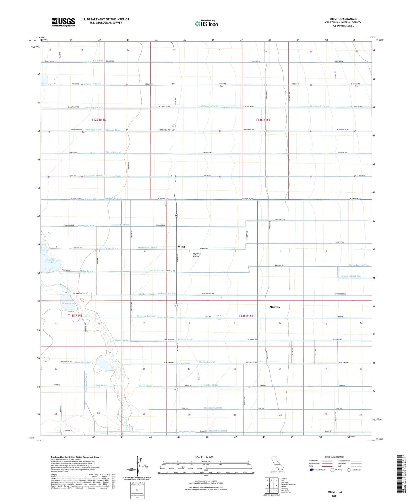
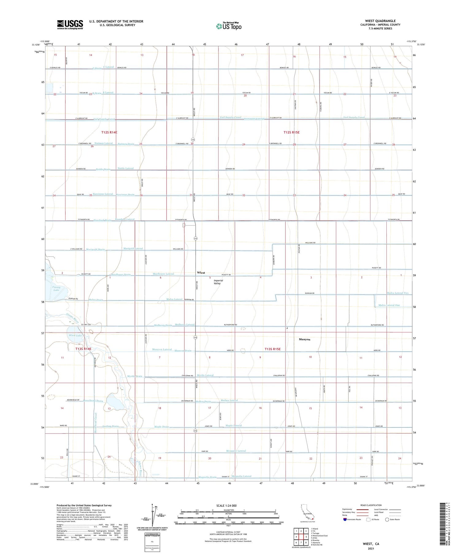
Wiest California US Topo Map
Couldn't load pickup availability
2021 topographic map quadrangle Wiest in the state of California. Scale: 1:24000. Based on the newly updated USGS 7.5' US Topo map series, this map is in the following counties: Imperial. The map contains contour data, water features, and other items you are used to seeing on USGS maps, but also has updated roads and other features. This is the next generation of topographic maps. Printed on high-quality waterproof paper with UV fade-resistant inks.
Quads adjacent to this one:
West: Westmorland East
Northwest: Niland
North: Iris
Northeast: Tortuga
East: Amos
Southeast: Holtville NE
South: Alamorio
Southwest: Brawley
This map covers the same area as the classic USGS quad with code o33115a4.
Contains the following named places: B Drain, B Lateral, Butlers, C Drain, C Lateral, Calipatria Drain Number Two, Darling Drain, Finney Lake, Gieselmann Lake, Magnolia Drain, Magnolia Lateral, Malva Drain, Malva Lateral, Maple Drain, Maple Lateral, Marigold Drain, Marigold Lateral, Mayflower, Mayflower Drain, Mayflower Lateral, Mesquite Lateral, Moorhead Canal, Moorhead Drain, Mulberry Drain, Mulberry Elementary School, Mulberry Lateral, Mullen Drain, Mullen Lateral, Munyon, Munyon Drain, Munyon Lateral, Myrtle Drain, Myrtle Lateral, Narcissus Drain, Narcissus Lateral, Nectarine Lateral, Nettle Drain, Nettle Lateral, Nutmeg Drain, Nutmeg Lateral, Standard Drain, Standard Lateral, Vail Supply Canal, Wiest, Wiest Lake