MyTopo
Jericho Valley California US Topo Map
Couldn't load pickup availability
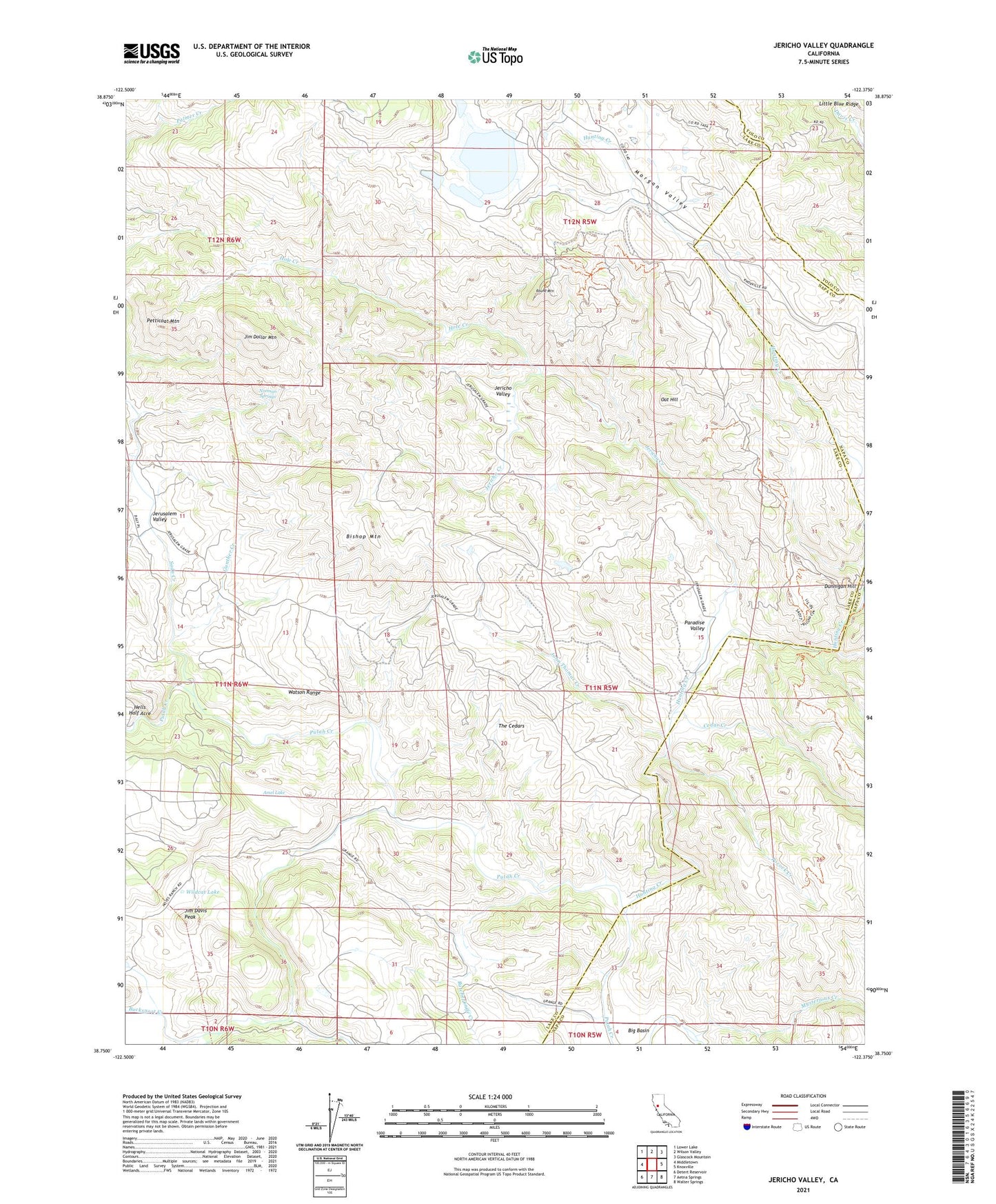
2021 topographic map quadrangle Jericho Valley in the state of California. Scale: 1:24000. Based on the newly updated USGS 7.5' US Topo map series, this map is in the following counties: Lake, Napa, Yolo. The map contains contour data, water features, and other items you are used to seeing on USGS maps, but also has updated roads and other features. This is the next generation of topographic maps. Printed on high-quality waterproof paper with UV fade-resistant inks.
Quads adjacent to this one:
West: Middletown
Northwest: Lower Lake
North: Wilson Valley
Northeast: Glascock Mountain
East: Knoxville
Southeast: Walter Springs
South: Aetna Springs
Southwest: Detert Reservoir
This map covers the same area as the classic USGS quad with code o38122g4.
Contains the following named places: Amel Lake, Bishop Mountain, Bucksnort Creek, Butcherknife Creek, Cedar Creek, Dunnigan Hill, Gunther Creek, Hells Half Acre, Hennesey Ranch, Hole Creek, Hunting Creek, Ink Ranch, Jericho Creek, Jericho Valley, Jerusalem Valley, Jim Davis Peak, Jim Dollar Mountain, John Thomas Creek, Morgan Valley, Mysterious Creek, Norman Springs, Oat Hill, Paradise Valley, Petticoat Mountain, Pocock Creek, Red Elephant Mine, Round Corral, Round Mountain, Soda Creek, The Cedars, Watson Range, West Coast Radio Receiving Station, Wildcat Lake