
MyTopo
Jimtown California US Topo Map
Couldn't load pickup availability
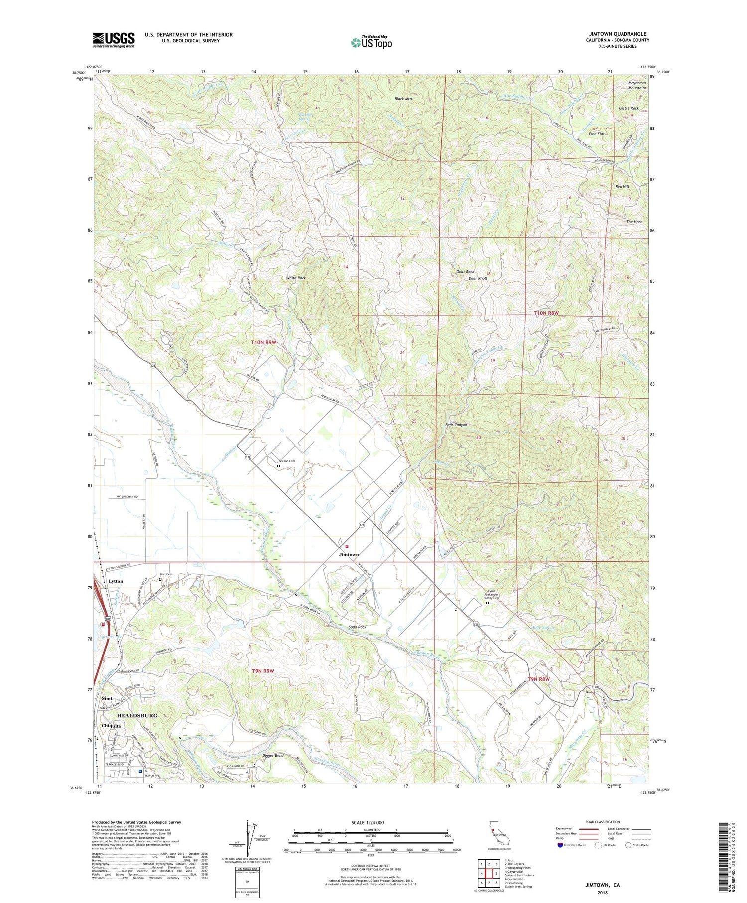
2021 topographic map quadrangle Jimtown in the state of California. Scale: 1:24000. Based on the newly updated USGS 7.5' US Topo map series, this map is in the following counties: Sonoma. The map contains contour data, water features, and other items you are used to seeing on USGS maps, but also has updated roads and other features. This is the next generation of topographic maps. Printed on high-quality waterproof paper with UV fade-resistant inks.
Quads adjacent to this one:
West: Geyserville
Northwest: Asti
North: The Geysers
Northeast: Whispering Pines
East: Mount Saint Helena
Southeast: Mark West Springs
South: Healdsburg
Southwest: Guerneville
This map covers the same area as the classic USGS quad with code o38122f7.
Contains the following named places: Alexander Valley Community Church, Alexander Valley Elementary School, Alexander Valley Post Office, Alexander Valley Vineyards, Anna Belcher Creek, Bear Canyon, Beeson Cemetery, Black Mountain, Buckeye Spring, Budge 3423 Dam, Burns Creek, Camp Maacama, Castle Rock, Chiquita, Circle S Ranch, Cyrus Alexander Family Cemetery, Deer Creek, Deer Knoll, Department of Forestry and Fire Protection Healdsburg Station, Digger Bend, Digger Bend Ranch, Douglas Ranch, Dry Creek Rancheria, Dry Creek Shopping Center, Field Stone Winery, Foss Creek Elementary School, George Young Creek, Geyserville Fire Protection District Station 2, Gibbs Park, Gird Creek, Goat Rock, Good Shepherd Lutheran Church, Grapevine Creek, Hall Cemetery, Healdsburg District Hospital, Hoot Owl Creek, Hurley Creek, Jimtown, Lovers Gulch Creek, Lytton, Lytton 2424 Dam, Lytton Creek, Mericoma Quicksilver Mine, Montvale Farm, Pine Flat, Red Hill, Ridge Ranch, Rio Lindo Adventist Academy, Sausal Creek, Sausal Winery, Simi, Simi Winery, Soda Rock, Soda Rock Winery, The Horn, White Rock


