MyTopo
Klinker Mountain California US Topo Map
Couldn't load pickup availability
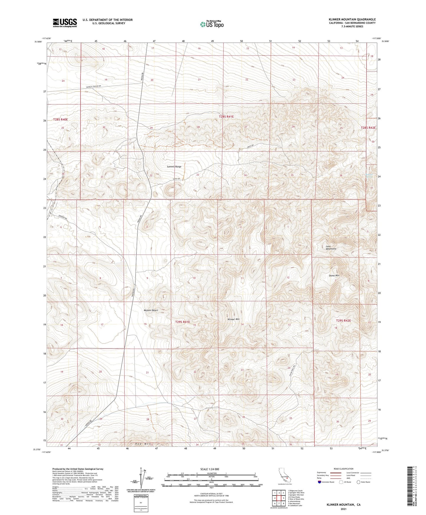
2021 topographic map quadrangle Klinker Mountain in the state of California. Scale: 1:24000. Based on the newly updated USGS 7.5' US Topo map series, this map is in the following counties: San Bernardino. The map contains contour data, water features, and other items you are used to seeing on USGS maps, but also has updated roads and other features. This is the next generation of topographic maps. Printed on high-quality waterproof paper with UV fade-resistant inks.
Quads adjacent to this one:
West: El Paso Peaks
Northwest: Ridgecrest South
North: Spangler Hills West
Northeast: Spangler Hills East
East: West of Black Hills
Southeast: Cuddeback Lake
South: Red Mountain
Southwest: Johannesburg
Contains the following named places: Bedrock Spring, Dome Mountain, Klinker Mountain, Lava Mountains, Little Dry Lake, Mountain Well, Skilling Well, Steam Well, Summit Diggings, Summit Range