MyTopo
La Costa Valley California US Topo Map
Couldn't load pickup availability
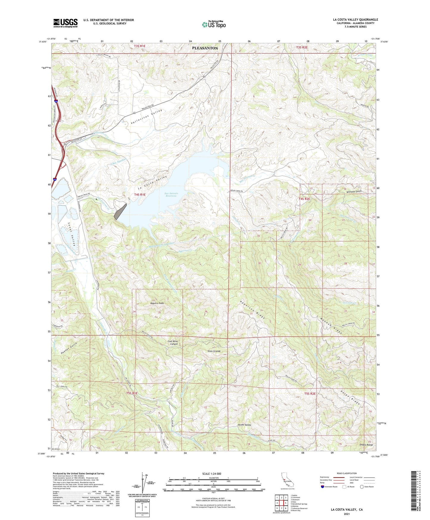
2021 topographic map quadrangle La Costa Valley in the state of California. Scale: 1:24000. Based on the newly updated USGS 7.5' US Topo map series, this map is in the following counties: Alameda. The map contains contour data, water features, and other items you are used to seeing on USGS maps, but also has updated roads and other features. This is the next generation of topographic maps. Printed on high-quality waterproof paper with UV fade-resistant inks.
Quads adjacent to this one:
West: Niles
Northwest: Dublin
North: Livermore
Northeast: Altamont
East: Mendenhall Springs
Southeast: Mount Day
South: Calaveras Reservoir
Southwest: Milpitas
This map covers the same area as the classic USGS quad with code o37121e7.
Contains the following named places: Apperson Creek, Apperson Ridge, Arroyo Del Valle Sanatorium, Calaveras Creek, Coal Mine Canyon, East Bay Regional Park District Ambulance Station 4, Haynes Gulch, Indian Creek, Indian Joe Creek, Jacobs Valley, James H Turner Dam, La Costa Creek, La Costa Valley, Leyden Creek, Maguire Peaks, San Antonio Creek, San Antonio Reservoir, Scotts Corner, South Fork Apperson Creek, Sunol Valley Regional Park, Vallecitos Atomic Laboratory, Vallecitos Valley, Vista Grande, Williams Gulch, ZIP Code: 94586