MyTopo
Mount Day California US Topo Map
Couldn't load pickup availability
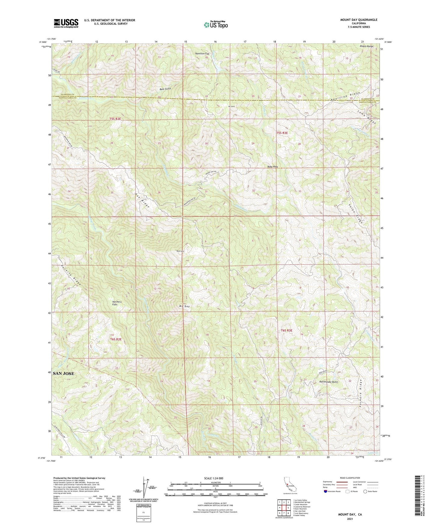
2021 topographic map quadrangle Mount Day in the state of California. Scale: 1:24000. Based on the newly updated USGS 7.5' US Topo map series, this map is in the following counties: Santa Clara, Alameda. The map contains contour data, water features, and other items you are used to seeing on USGS maps, but also has updated roads and other features. This is the next generation of topographic maps. Printed on high-quality waterproof paper with UV fade-resistant inks.
Quads adjacent to this one:
West: Calaveras Reservoir
Northwest: La Costa Valley
North: Mendenhall Springs
Northeast: Cedar Mountain
East: Eylar Mountain
Southeast: Isabel Valley
South: Lick Observatory
Southwest: San Jose East
This map covers the same area as the classic USGS quad with code o37121d6.
Contains the following named places: Baby Peak, Bear Gulch, Beartrap Ridge, Black Mountain, Camp Ohlone Regional Park, Hamilton Flat, Isabel Creek, Lamb Ridge, Mount Day, Mount Lewis, New Camp, Oak Ridge, Ogier Ranch, Old Camp, Packard Ridge, Patton Ranch, Poverty Ridge, Rattlesnake Butte, Smith Creek, Valpe Creek, Valpe Ridge, Van Horn Flats, ZIP Code: 95132