MyTopo
Lake Fulmor California US Topo Map
Couldn't load pickup availability
Also explore the Lake Fulmor Forest Service Topo of this same quad for updated USFS data
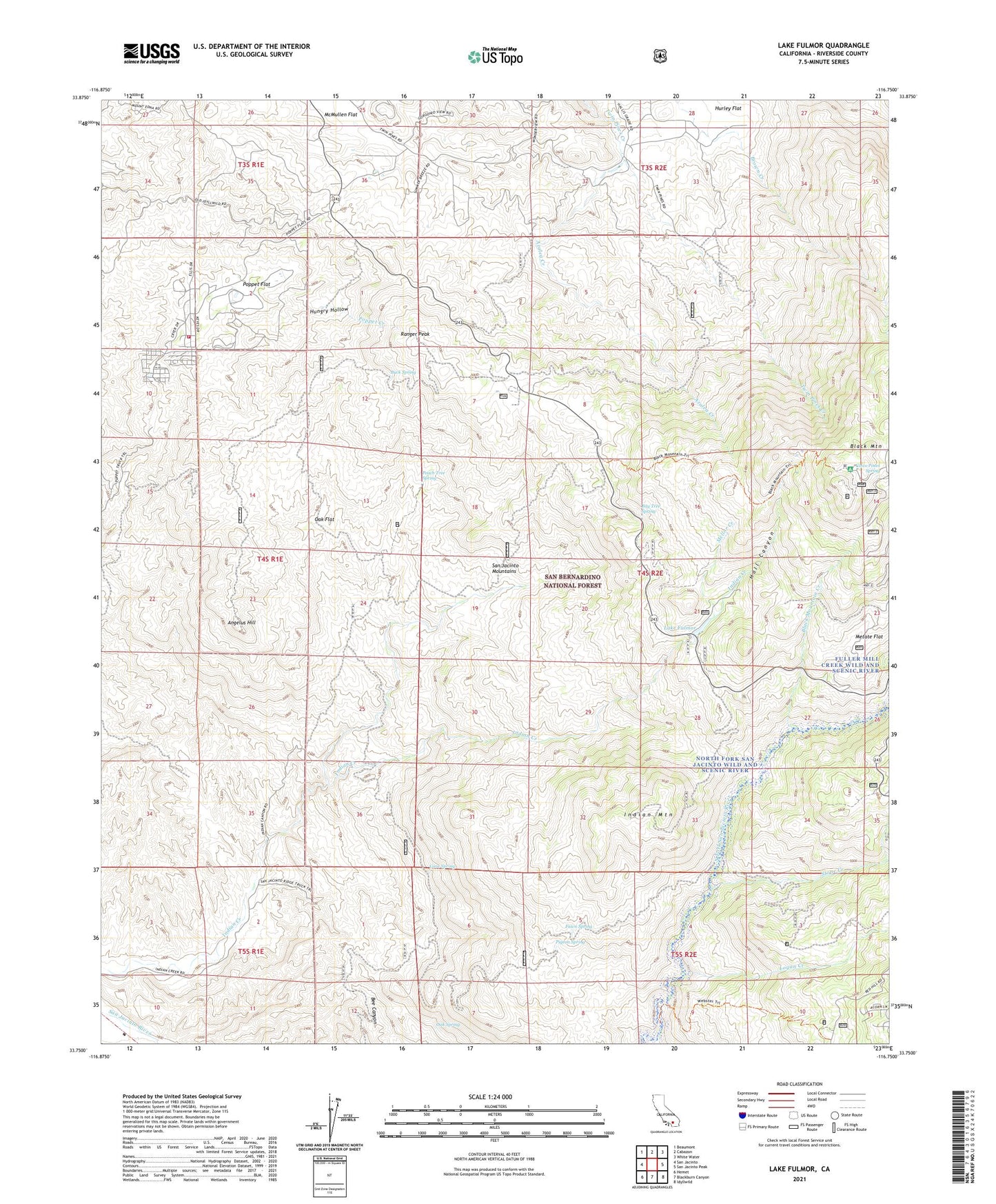
2021 topographic map quadrangle Lake Fulmor in the state of California. Scale: 1:24000. Based on the newly updated USGS 7.5' US Topo map series, this map is in the following counties: Riverside. The map contains contour data, water features, and other items you are used to seeing on USGS maps, but also has updated roads and other features. This is the next generation of topographic maps. Printed on high-quality waterproof paper with UV fade-resistant inks.
Quads adjacent to this one:
West: San Jacinto
Northwest: Beaumont
North: Cabazon
Northeast: White Water
East: San Jacinto Peak
Southeast: Idyllwild
South: Blackburn Canyon
Southwest: Hemet
This map covers the same area as the classic USGS quad with code o33116g7.
Contains the following named places: Alandale Forest Service Facility, Angelus Hill, Azalea Creek, Bay Tree Spring, Bee Canyon Truck Trail, Black Mountain Creek, Black Mountain Scenic Area, Black Mountain Trail, Black Mountain Truck Trail, Boulder Basin Group, Browns Ranch, Buck Spring, Cave Spring, Chappel Ranch, Cinco Poses Spring, Cinco Poses Trail, Ditch Creek, Fawn Spring, Hall Canyon, Hall Mill 826 Dam, Halldecker Campground, Hungry Hollow, Hurley Flat, Indian Creek Truck Trail, Indian Mountain, Lake Fulmor, Lake Fulmor Picnic Area, Logan Creek, McMullen Flat, Mellor Creek, Mellor Ranch, Metate Flat, Mount Oak Boys Ranch, North Fork San Jacinto Wild and Scenic River, Oak Flat, Oak Spring, Peach Tree Spring, Pigeon Spring, Point View, Poppet Flat, Poppet Flat Divide Truck Trail, Ranger Peak, Ranger Peak Lookout, Riverside County Fire Department Station 63 - Poppet Flats, San Jacinto Ridge Truck Trail, Stone Creek, Stone Creek Campground, Trailfinders Camp, Twin Pines Ranch, Vista Grande Guard Station, ZIP Code: 92549