MyTopo
Le Grand California US Topo Map
Couldn't load pickup availability
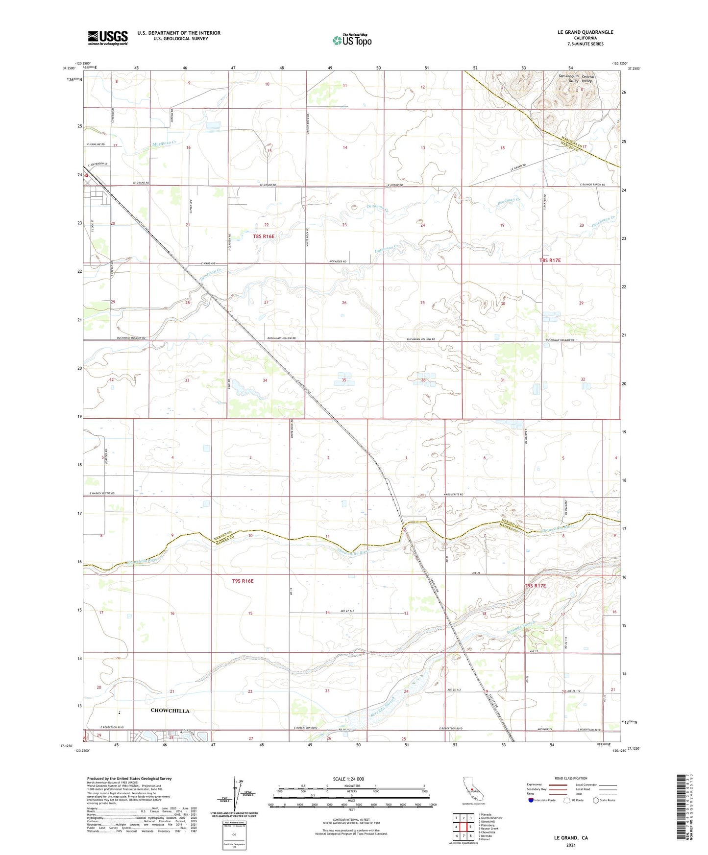
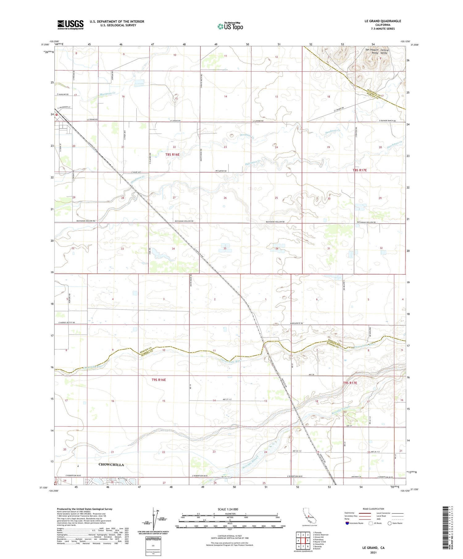
2021 topographic map quadrangle Le Grand in the state of California. Scale: 1:24000. Based on the newly updated USGS 7.5' US Topo map series, this map is in the following counties: Merced, Madera, Mariposa. The map contains contour data, water features, and other items you are used to seeing on USGS maps, but also has updated roads and other features. This is the next generation of topographic maps. Printed on high-quality waterproof paper with UV fade-resistant inks.
Quads adjacent to this one:
West: Plainsburg
Northwest: Planada
North: Owens Reservoir
Northeast: Illinois Hill
East: Raynor Creek
Southeast: Kismet
South: Berenda
Southwest: Chowchilla
This map covers the same area as the classic USGS quad with code o37120b2.
Contains the following named places: Appling School, Berenda Slough 1015 Dam, Dickenson, KXDA-FM (Chowchilla), Le Grand, Marguerite, Medano, Merced County Fire Department Le Grand Fire Station 84, Reimer Farms, Vineyard School, Wells Nut Farm, ZIP Code: 95333