
MyTopo
Planada California US Topo Map
Couldn't load pickup availability
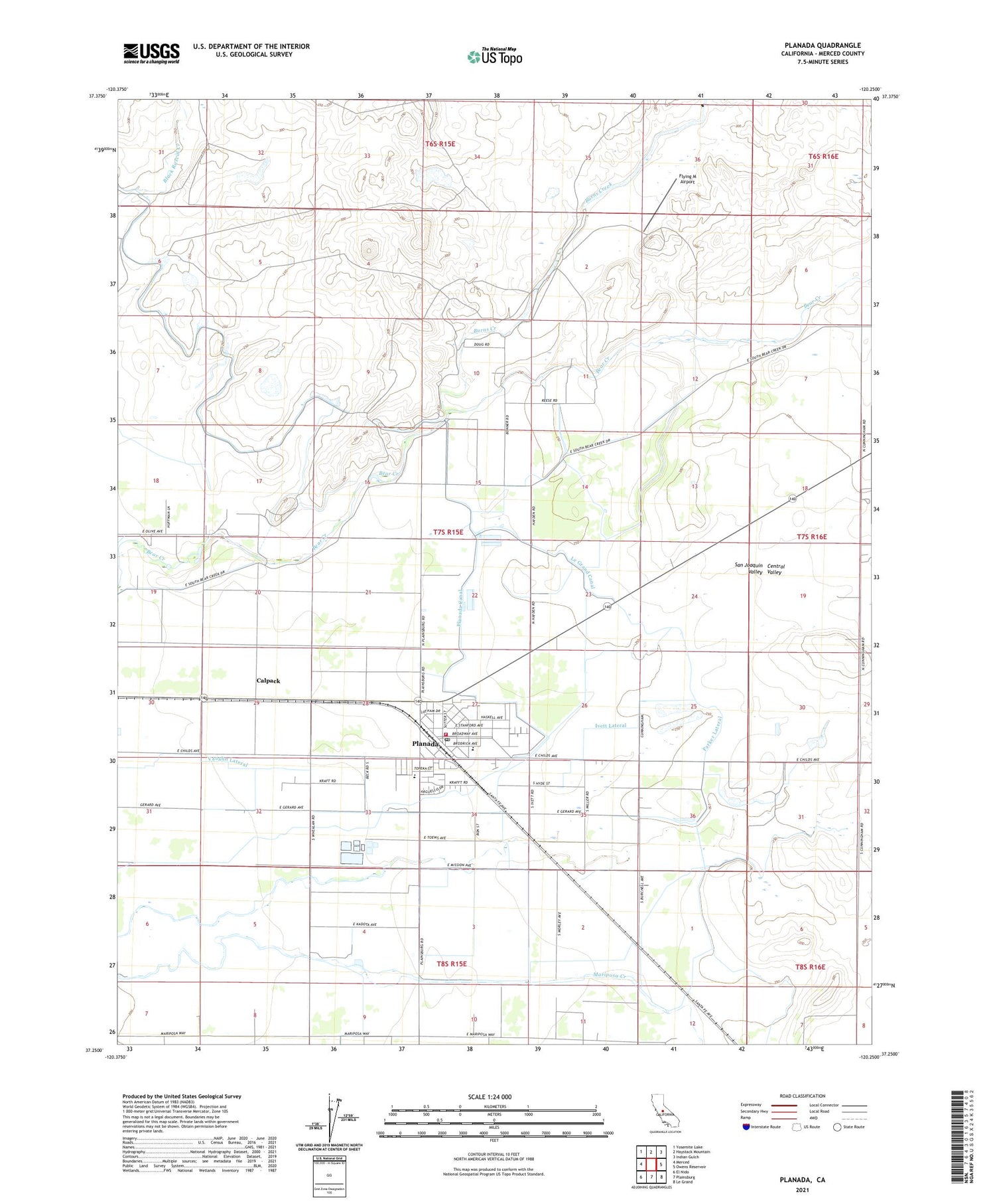
2021 topographic map quadrangle Planada in the state of California. Scale: 1:24000. Based on the newly updated USGS 7.5' US Topo map series, this map is in the following counties: Merced. The map contains contour data, water features, and other items you are used to seeing on USGS maps, but also has updated roads and other features. This is the next generation of topographic maps. Printed on high-quality waterproof paper with UV fade-resistant inks.
Quads adjacent to this one:
West: Merced
Northwest: Yosemite Lake
North: Haystack Mountain
Northeast: Indian Gulch
East: Owens Reservoir
Southeast: Le Grand
South: Plainsburg
Southwest: El Nido
This map covers the same area as the classic USGS quad with code o37120c3.
Contains the following named places: Bear Creek, Burchell, Burns Creek, Calpack, Cunningham School, Dibblee Lateral, Double Creek Ranch, Flying M Airport, Granada High School, Hadley Lateral, Hillcrest Dairy, Ivett Lateral, Le Grand Canal, Mayo Dairy Number 1, Merced County Fire Department Planada Fire Station 86, Merced County Sheriff's Office Planada, Parker Lateral, Planada, Planada Canal, Planada Census Designated Place, Planada Elementary School, Planada Post Office, Planada-Le Grand Division, Vaughn Lateral, ZIP Code: 95365


