MyTopo
Little Lake California US Topo Map
Couldn't load pickup availability
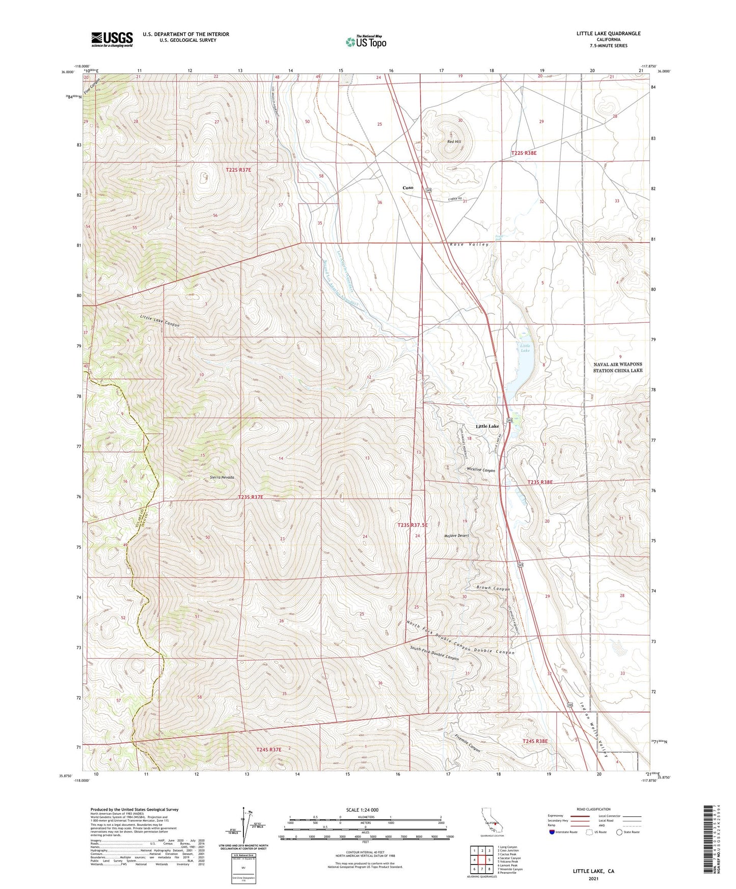
2021 topographic map quadrangle Little Lake in the state of California. Scale: 1:24000. Based on the newly updated USGS 7.5' US Topo map series, this map is in the following counties: Inyo, Tulare. The map contains contour data, water features, and other items you are used to seeing on USGS maps, but also has updated roads and other features. This is the next generation of topographic maps. Printed on high-quality waterproof paper with UV fade-resistant inks.
Quads adjacent to this one:
West: Sacatar Canyon
Northwest: Long Canyon
North: Coso Junction
Northeast: Cactus Peak
East: Volcano Peak
Southeast: Pearsonville
South: Ninemile Canyon
Southwest: Lamont Peak
This map covers the same area as the classic USGS quad with code o35117h8.
Contains the following named places: Brown Canyon, Coso, Double Canyon, Fossil Falls, Indian Wells Valley, Little Lake, Little Lake Canyon, North Fork Double Canyon, Red Hill, Rose Valley, Sacatar Trail Wilderness, South Fork Double Canyon, Wickline Canyon