
MyTopo
Ninemile Canyon California US Topo Map
Couldn't load pickup availability
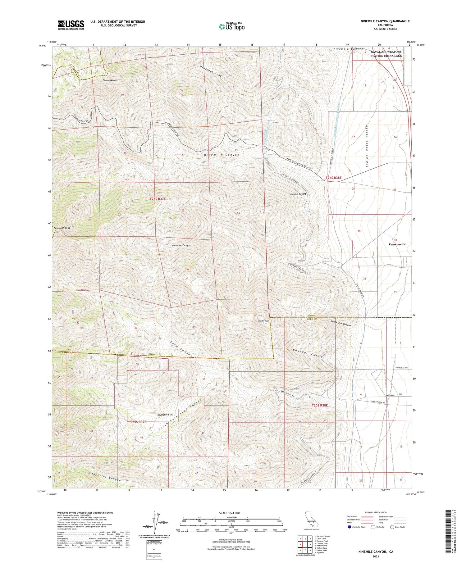
2021 topographic map quadrangle Ninemile Canyon in the state of California. Scale: 1:24000. Based on the newly updated USGS 7.5' US Topo map series, this map is in the following counties: Inyo, Kern, Tulare. The map contains contour data, water features, and other items you are used to seeing on USGS maps, but also has updated roads and other features. This is the next generation of topographic maps. Printed on high-quality waterproof paper with UV fade-resistant inks.
Quads adjacent to this one:
West: Lamont Peak
Northwest: Sacatar Canyon
North: Little Lake
Northeast: Volcano Peak
East: Pearsonville
Southeast: Inyokern
South: Owens Peak
Southwest: Walker Pass
This map covers the same area as the classic USGS quad with code o35117g8.
Contains the following named places: Boulder Canyon, Boulder Peak, County Line Canyon, Deadfoot Canyon, Fivemile Canyon, Ninemile Canyon, Noname Canyon, Pearsonville Census Designated Place, Rodecker Flat, Sand Canyon, Sawtooth Peak, South Fork Sand Canyon


